

This trail has been on my bucket list for two years. Both years I’ve looked at it the weather just never seemed right and the time off was hard to get. The Canada day long weekends Friday was a short shift and with 3 days off I figured I could do the trail in 4 days 3 nights. I chose to do it counterclockwise.
June 29th 2018
I drove into work early, finished my shift then drove up. While driving along the 637 a crazy rain storm hit and finished just as I arrived at the park. I got my permit, drove to the parking lot. Spent a good 10 minutes making sure everything was ready to go and at 11:14 I was off.
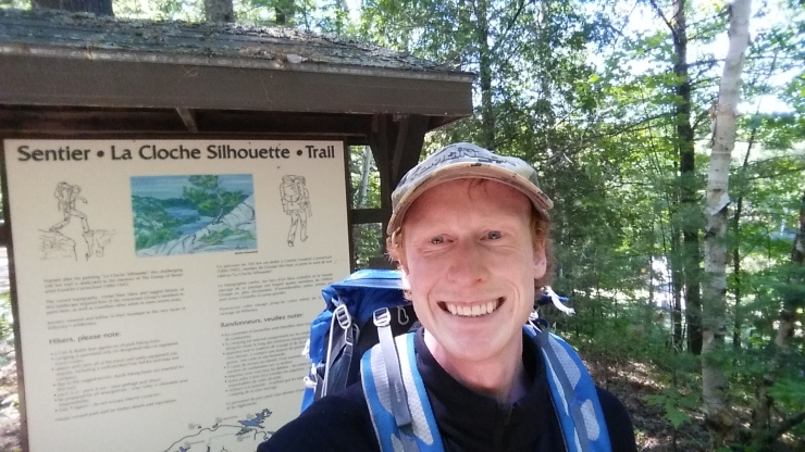
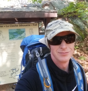 Starting selfie.
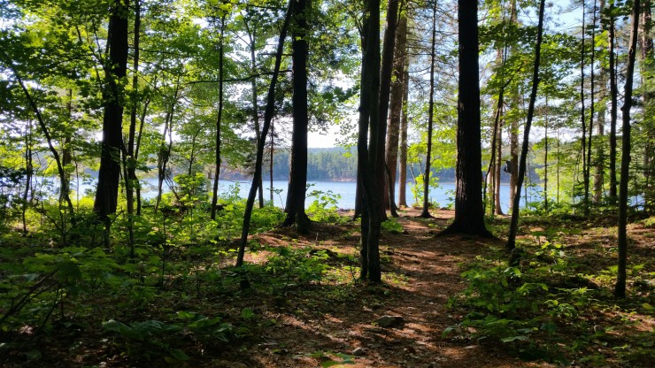
The first 8 km of the hike is very flat with rolling hills. There are a few reservable campsites and a couple “bail out” sites for those who are too tired to continue.
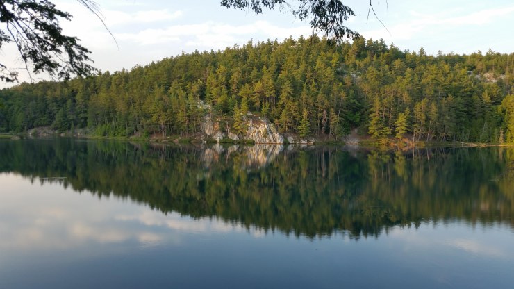
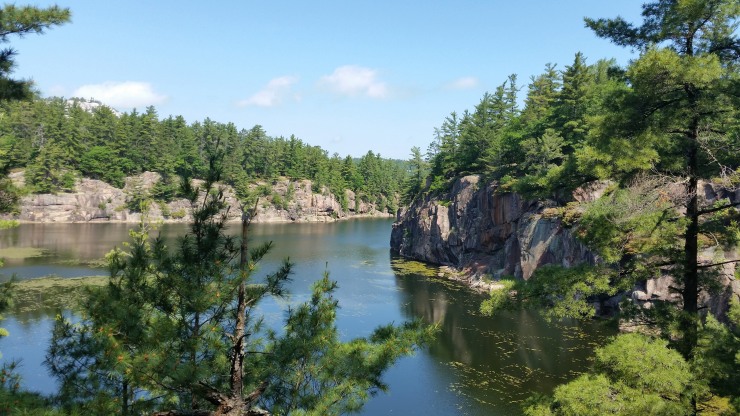 Little Sheguiandah Lake.
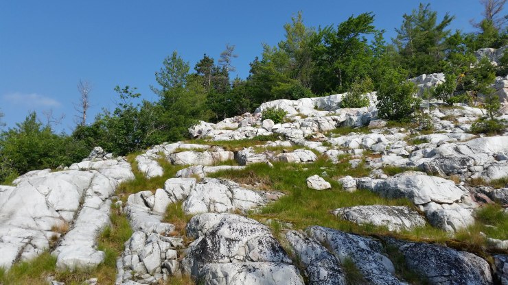
At the 7.1 km mark is when the hike up to “The Crack” begins. I told myself I wouldn’t take a snack until I hiked all the way to the top. This was a bad idea. It was 13:15 and already 34°C with the humid ex and would rise to 37°C. I had reached the top at 13:48. and took a good long break to get much much needed water and food.
 The view from the top of “The Crack” at 342 meters.
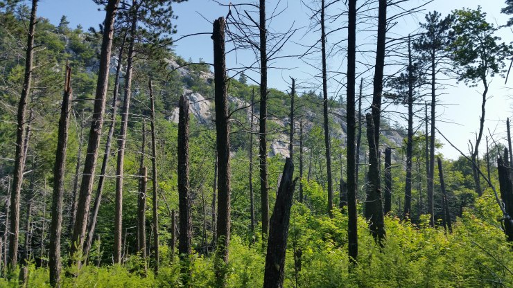
It was already 8.3 km in and the heat was starting to hit me pretty hard. The next 9 km is a very hard portion of the trail with 310 m ascent and 475 m of descent. The trail is very easy to follow but it is rough. All the climbs and descents are fairly steep, rocky and you have to watch your step.
 View of Silver Peak in the distance a kilometer past “The Crack”.
 View of Bunny Lake from campsite H45.
Around 1 am a crazy thunder storm rolled in. Every 10 seconds the sky would light up but no sound. This continued for a while then the wind hit. For the first 10 seconds it sounded like a jet engine was taking off right beside my tent, then silence! Then the wind came in and sent my tent walls almost horizontal. They were touching my toes and just a few inches from my face. The wind stopped and the rain started. It sounded like a waterfall for a bit then it got lighter. I woke up in the morning with a pool of water below my tent but nothing had seeped in. The tent pegs were still in all 4 corners of my tent.
June 30th 2018
I started off at 09:51 and the temperature was already 30°C with humidex. Just a few hundred meters from H45 there was a great view of Silver Peak.
 The Blue Ridge and Silver peak.
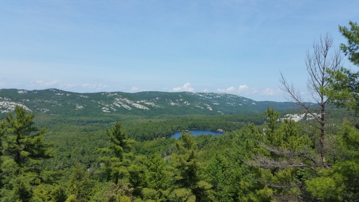
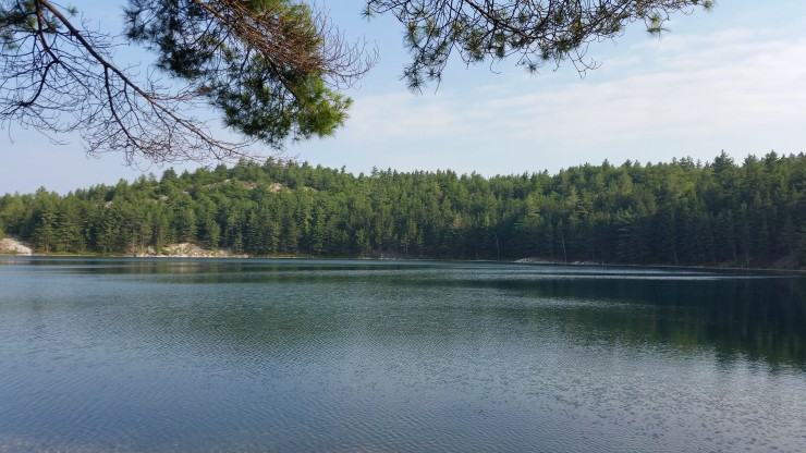
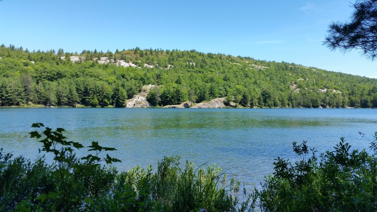
 Silver Lake at km 21.8.
From Silver Lake, the next 3km of trail is very flat until the turn off to Silver Peak. I had already hiked Silver Peak in a previous trip so I didn’t do it this time. Plus the sky was getting dark and it looked like it was going to rain.
 Approaching storm 300 meters past the turn off to Silver Peak.
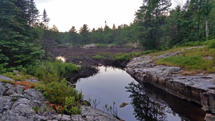 Great little water refill spot at km 26.1.
After the turn off the trail gets really difficult from here. The trail climbs steeply 66 m then levels off on the North side of Silver Peak.
 North of Silver Peak.
On the north side the trail is relatively flat until just before Little Mountain Lake. Then there are several very steep sections. From km 31 to km 34 the trail rises steeply 100 m then drops steeply 150 m only to climb again 130 m.
 Little Mountain Lake at km 32.5
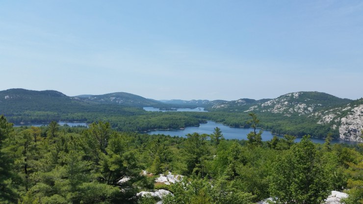
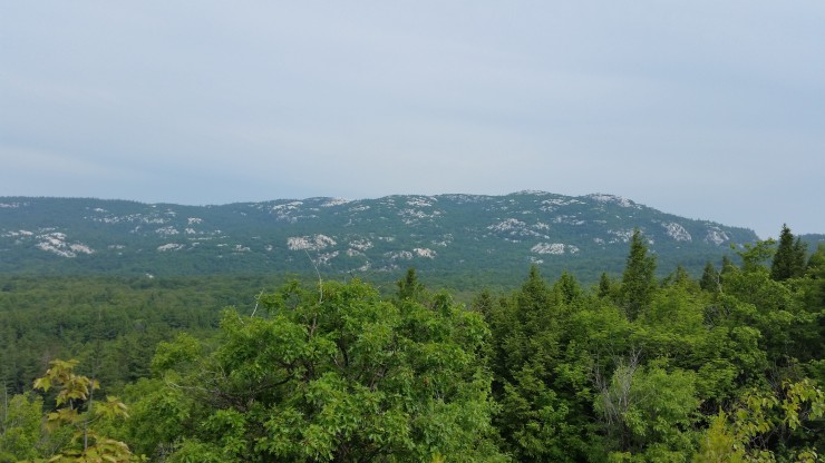
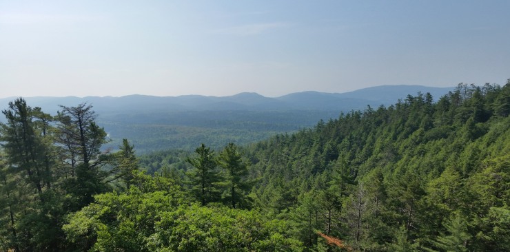
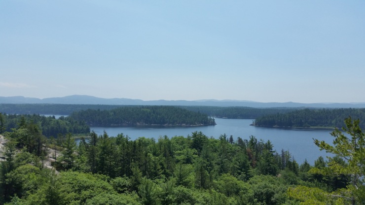
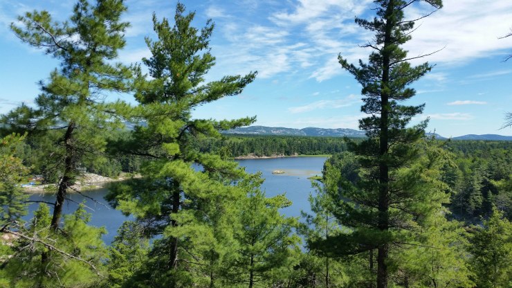
The feature Image was taken at km 33.2 which in my opinion is the best view of the trail. There was a lot of haziness in the sky due to the humidity.
At km 35.5 I made to my campsite for the second night.
 H31 Campsite on Shigaug Lake.
After finishing dinner, I was about to go for a swim when a girl named Jessica arrived at my campsite pretty tired, looking for her site. She asked to stay the night at my site because she couldn’t find her site and it was already 8 pm. The company was nice. Because I was doing the hike counterclockwise I ran into everyone going the more popular direction but no one was in the mood to talk. She was going clockwise and hadn’t seen anyone all day.
July 1st 2018
 Blurry selfie taken that morning.
Today was the hottest of the trip with temperatures hitting 42 with humidity. My whole trip was documented on my cell phone. My body was in a constant state of “stay cool” to the point where my pants were constantly damp. I record and take my photos with my phone. This dampness really messed with the touch screen. But I couldn’t dry it off on my pants or shirt because they were to damp. A new experience for sure! This was also my longest day. The first km was a breeze until km 36.5 Then there was a constant uphill climbing 177 m over 3 km to the highest point in the trail (unless you climb Silver Peak) at 420 m.
 The trail at km 37.1
 Really cool lunch break spot at km 38.8.
 Blue Ridge in the background at km 39.2
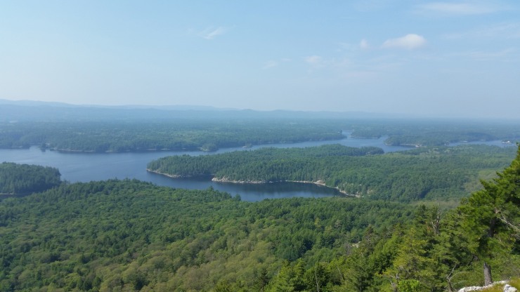 View of Threenarrows from the top of the climb at km 39.8
From here the trail drops 154 m in 700 m then climbs 86 m in 400. The trail follows a beautiful stream until the waterfall at km 42.9.
 Waterfall facing clockwise (I got to go down this) at km 42.9
The trail keeps following the stream until the 30 meter class 3 scramble at km 43.6. I would have hated to go down this with a heavy pack. This is one of the reasons I decided to hike the trail counter clockwise.
 View of Threenarrows Lake after the climb. The Blue Ridge 7 km in the distance.
The next 12.7 km of the trail meanders around Threenarrows Lake. It is relatively flat with only small elevation gains and losses. There are several campsites and a few bailout sites.
 H16 through the trees at km 56.3
When I had got there, there was already a couple set up because they didn’t want to hike all the way to their site. It hit 42°C that day so could you blame them. They offered to move their tent but I had already set up mine was perfectly ok with the company. We had a small Canada Day fire then I went to bed.
July 2nd 2018
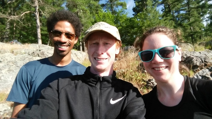 Megan and Andrew
The first 2.5 km was pretty uneventful until I got a choice to either cross a dam or go around it. Being true to the trail I decided to go around. If you by pass the bridge and cross the dam you save 3 km of trail.
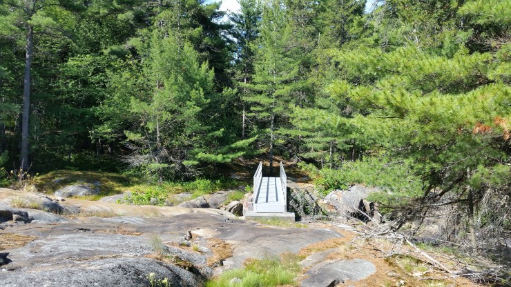 Bridge
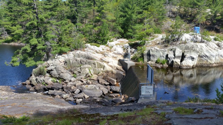 The dam if you choose the shortcut.
The last view of Threenarrows Lake was at km 62.6 when “The Pig” portage began for me.
 Last view of Threenarrows Lake.
From here the hike follows “The Pig” portage which is the tallest portage in the park. At km 66 is the final real uphill of the trail. There is 147 m of elevation gain in 700 meters. The climb is worth it because shortly after the climb I got to Acid Lake.
 Acid Lake at km 68.3.
This is the last spot I refilled my water. The last 7.7 km was just a blur. The trail started to get pretty popular with people walking their dogs in flip flops and other just starting out their trip not knowing what to expect. There was nothing really of interest until the end at km 76!
 Victory selfie at George Lake.
Something I overlooked when planning the trip was the final 1.5 km that you have to walk through the park to get to your parked car. You get a lot of weird looks walking through the park with a backpack on.
Click on the  icon to make the Google Map full screen, to see all the photos I took and where they were taken. Click on the
  symbol to see all the photos. There are 43 in total. I colour coded each day. Purple is day 1, burgundy is day 2, orange is day 3, yellow is day 4.
Here is a little video highlighting the lookouts along the trail: https://www.youtube.com/watch?v=wMmRtjqR9Yc
Stats:
June 29th 18.2 km 763 m elevation gain 735 m descent High 37°C w/ Humid ex
June 30th 18.6 km 939 m elevation gain 861 m descent High 37°C w/ Humid ex
July 1st 21.6 km 782 m elevation gain 890 m descent High 42°C w/ Humid ex
July 2nd 17.5 km 616 m elevation gain 633 m descent High 31°C w/ Humid ex + 1.5 km walking along the road
Total: 76.5 km + 3161 m climb 3163 m descent
There is a small section around Freeland Lake for about 1 km that my gps wasn’t working I took this into account through the whole post.

76km! That’s pretty intense. How were your feet after? I am wondering what is the pile of rocks in the picture at Silver Peaks? Is it man-made?
LikeLike
Feet were blistered because of the heat. The rocks are cairns showing hikers were to go.
LikeLike