
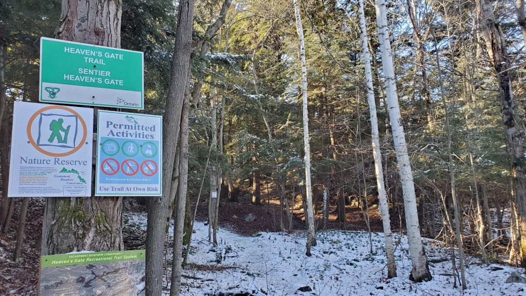
At group climb in late October Steven asked me “have you ever hiked Heaven’s Gate Trail”. I said “no but I’d be down to do it after deer gun season”. We waited patiently as the weather through November slowly got worse. After reviewing webcams and the weather for the surrounding area the week after gun season looked doable.
I found one GPS file on AllTrails and it showed campsites at km 11.5, 20 and 31 starting from the Provincial Park and ending in Willisville. We left work early Friday, parked one car at the Provincial Park then drove to the trail head in Willisville.
I chose to hike in running shoes to lower the weight on my feet and because hiking boots have always given be blisters. There was a light dusting of snow for the majority of the first section of the hike and was slightly cold on my feet. Very quickly we started to climb up and down unevenly placed rocks followed by sections of forest bed. Several times having to resort to hands and knees for the climbs and sitting down on our butts for the descents.

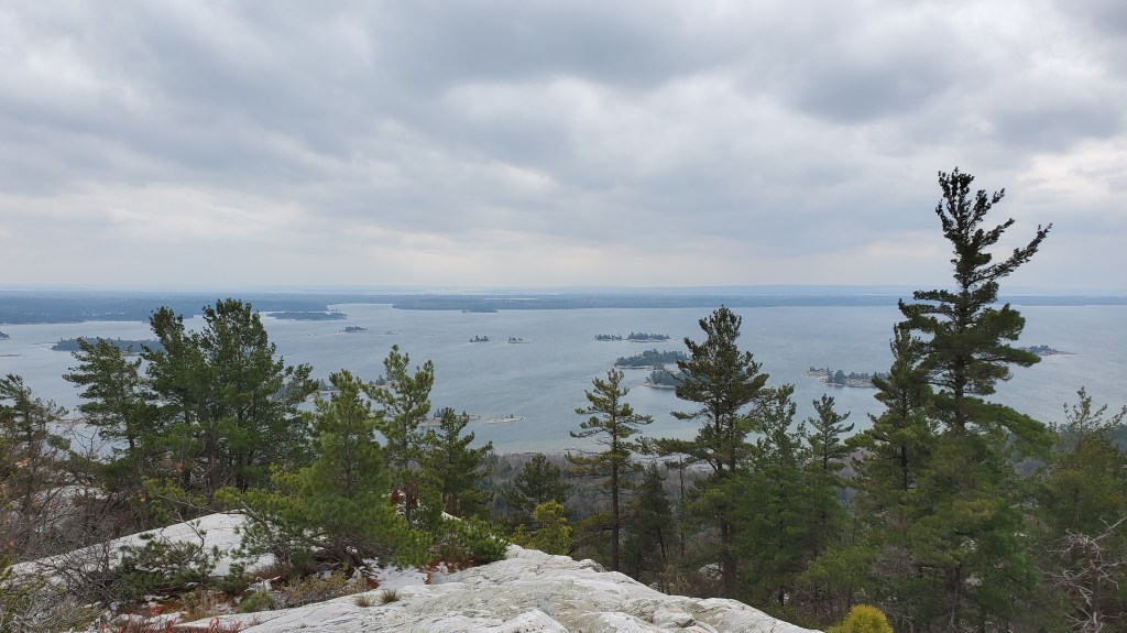
The day 1 highlight is reaching the top of Mount Ararat. Starting at km 5 until the top at km 7 the trail steadily climbs.

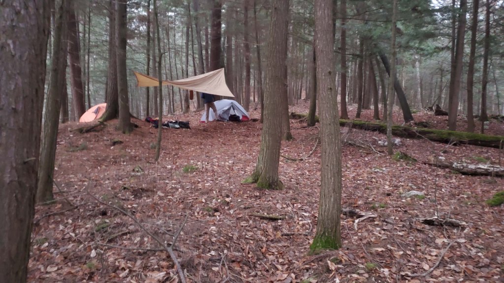
The next km to the campsite is a fairly steep downhill averaging a -15% grade. The campsite was huge with room for many tents. There was a cabin there that we slept in.
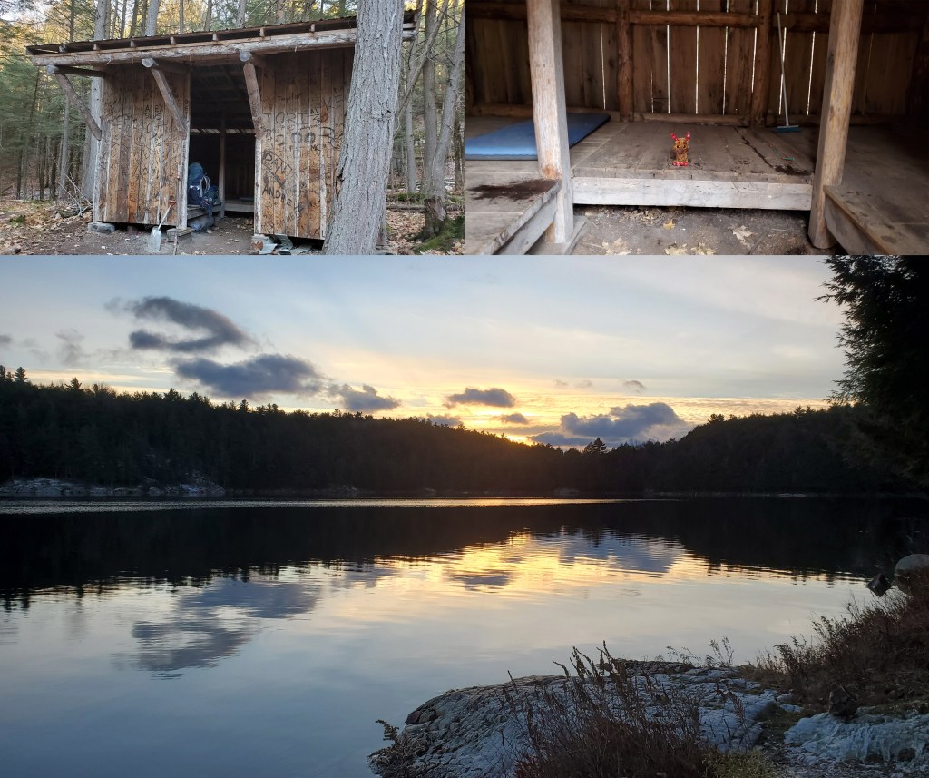
We went to bed at 19:00. The temperature dropped below zero and I froze! I only have a 5°C sleeping bag and summer pad. I slept in all my layers but it wasn’t enough. Throughout the night Yrsa (Steven’s Dog) was playing with something in the cabin. When we woke up we found this creepy dog toy. (in the photo above)
Day 2
We woke up ate breakfast and started hiking around 8:30am. The trail started to get less well marked, more rugged and had more snow. From here on out the trail markers were often nailed to trees that had fallen over. Most cairns were grown over by junipers. It was super handy having two people constantly looking for trail. Neither Steven or I knew what Heaven’s Gate actually looked like and so the running joke throughout the hike was “is this Heaven’s Gate?” At first we thought it was the two hills towering over Alexander Lake.
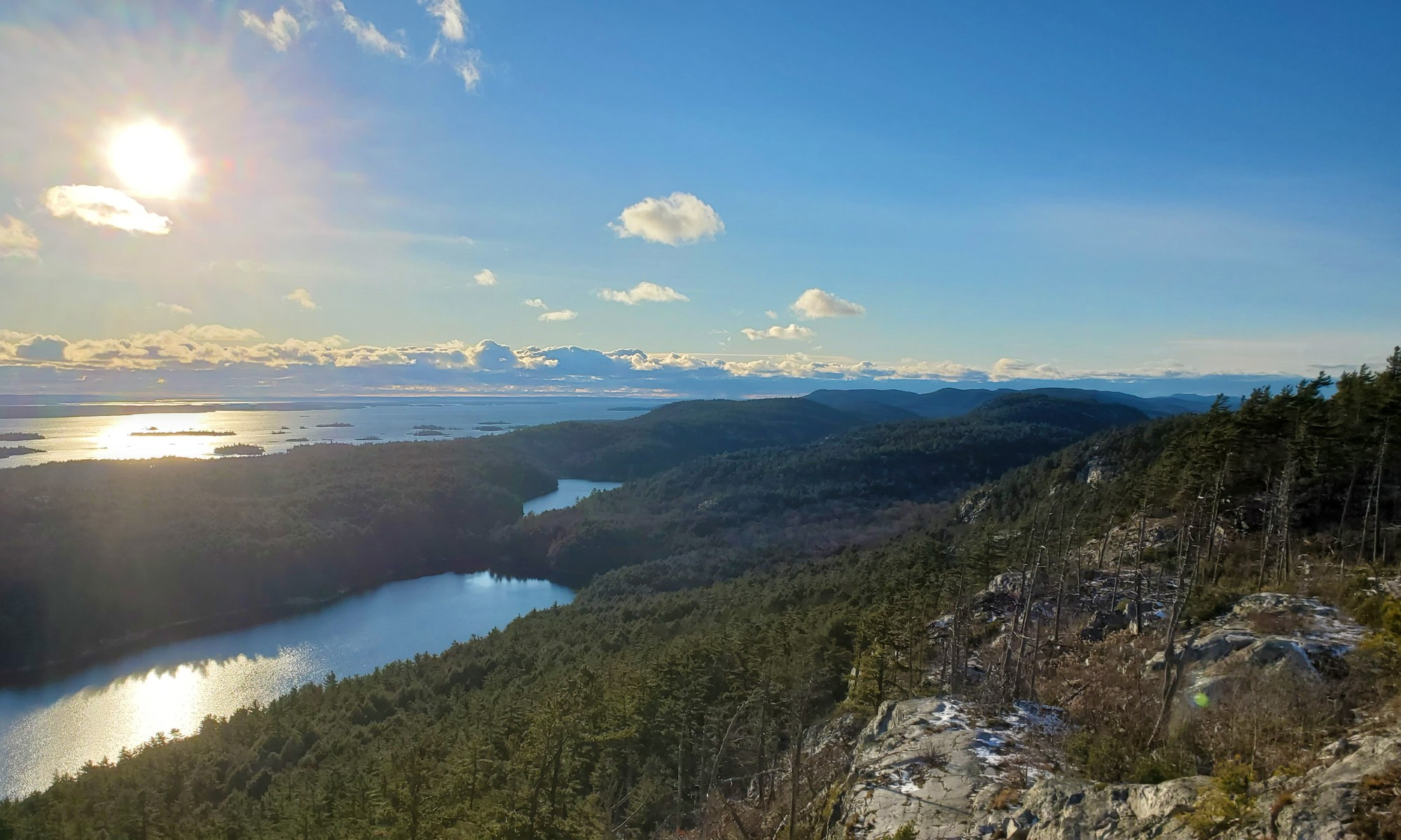
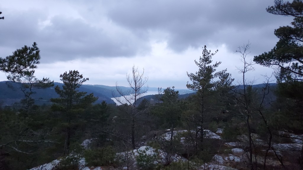
The trail continues with downhill and uphill sections with beautiful South facing mountain peaks.
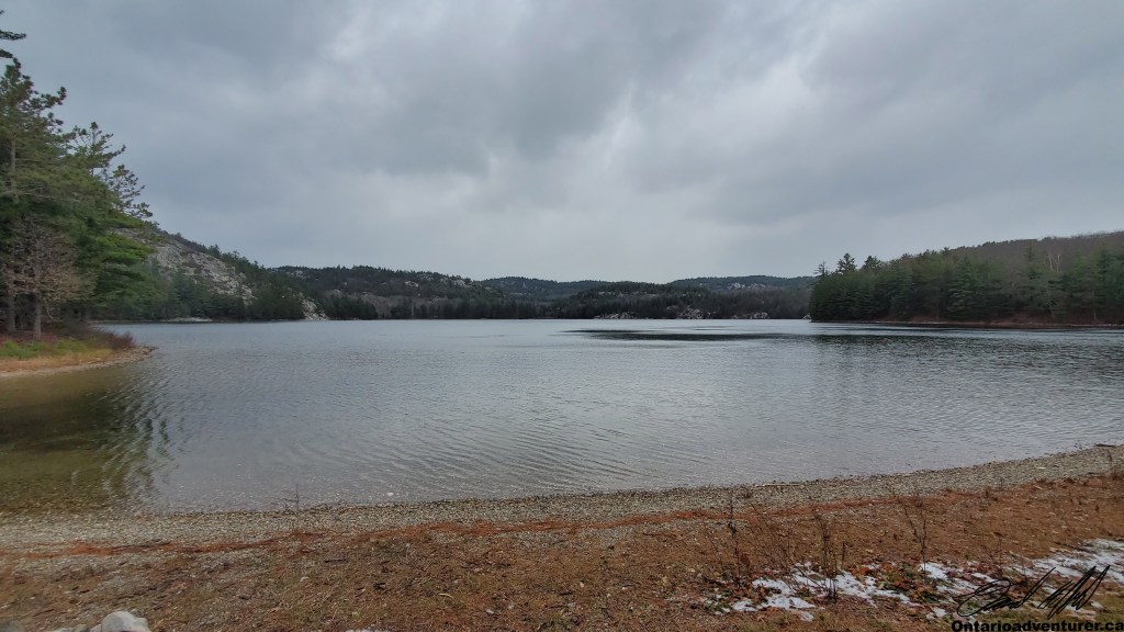
After three peaks and a short downhill section there is a nice forested section on your way to Wrights Lake. This campsite overs room for several tents and a lovely beach. We ate lunch here. I was unable to get cell phone reception on Wrights Lake.
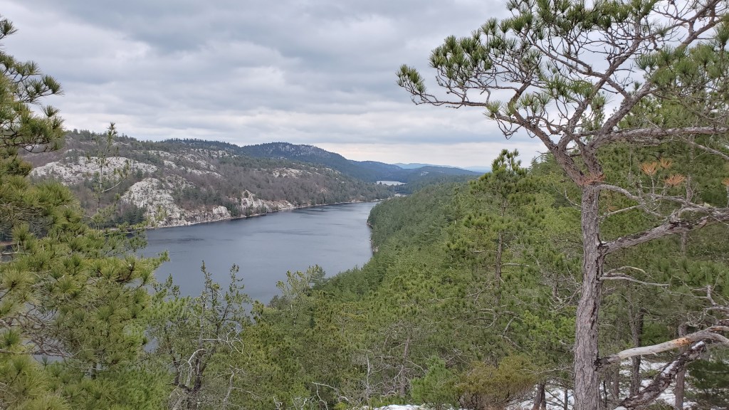
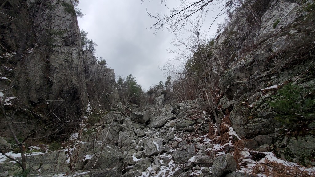
Only 500 meters further we hit Heaven’s Gate. It is very aptly named with two towering cliffs on either side and a decent scramble through the middle. There is a beautiful lookout at the top.
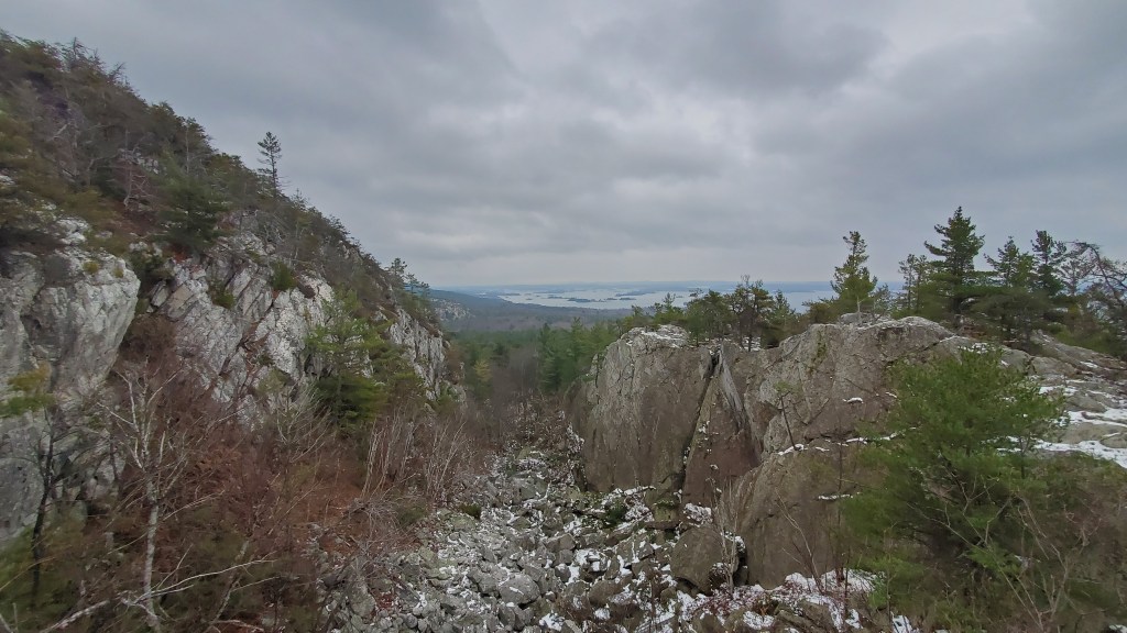
From here we continued west along the tops of ridges. 16km in there was a water refill spot that we opted not to use. Instead, we filled up 19.3km in at White’s Lake thinking there might be a site there. (there was not) The ridges offered beautiful views and 20km in we got to a high point overlooking La Cloche Lake.
After 21.4km we made it to our campsite for the night. There was no cell reception at the site but the night was much warmer than the first night!
Day 3
The last day started off with a very poorly marked trail with orange trail marker and white blazes that seemed to contradict each other. There were many campsites in this first section.

There were beautiful wetlands and cool looking cliffs along this portion of the trail. It was raining and overcast for most of the day so the lookouts weren’t clear. The last 3 km of trail is along an ATV trail which is much deserved. The trail ends with a waterfall.
Heaven’s Gate was a challenging trail but totally worth it. If you’re looking for an adventure and a less travelled path I highly suggest this trail. If it were longer it would be harder than La Cloche.

Click on the ![]() icon to make the Google Map full screen, to see all the photos I took and where they were taken. Click on the
icon to make the Google Map full screen, to see all the photos I took and where they were taken. Click on the ![]() symbol to see all the photos. There are 51 in total. I colour coded each day. Purple is day 1, Blue is day 2, Yellow is day 3. I tried to take a photo of every campsite I saw to help you out in trip planning.
symbol to see all the photos. There are 51 in total. I colour coded each day. Purple is day 1, Blue is day 2, Yellow is day 3. I tried to take a photo of every campsite I saw to help you out in trip planning.
Stats:
November 19th: 8.8km 338m elevation gain 369m elevation loss
November 20th: 21.4km 766m elevation gain 778 elevation loss
November 21st: 13.3km 499m elevation gain 541 elevation loss
