
While researching the Adirondacks I also searched for the highest point in Ontario out of curiosity. I figured it would be in the middle of nowhere accessible only by plane. To my luck it was only an hour north of Sudbury.
I drove up Friday night after work expecting to put a few kilometers into my hike but I didn’t end up getting to the river crossing until 8 pm. I only had about an hour left of sunlight so I decided to camp close by.

My campsite for the night
I woke up the in the morning colder than I have been in a very long time. I got out of my tent to frost covering the entire tent and ground. I grabbed my sleeping bag, my wool blanket, turned on the car and blasted the heat. Not until later in the day did I find out it went down to -6°C over night. After about 30 minutes in my car warming up, I packed my stuff and went to scout out the river crossing.
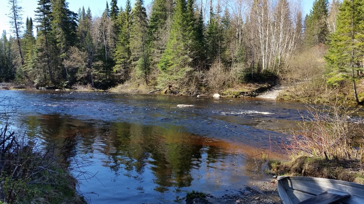 River Crossing (once I made it across)
I tied a 6mm rope to a post, threw on my life jacket and crossed it without any stuff just to test the waters. The water was just above knee high, however the water wasn’t moving as fast as I thought. So then I went back to get all my stuff. I left my rope, water shoes and life jacket in the bushes just to the side and then set off on my bike. About 5 km in there was a short creek crossing with no current.
 Creek Crossing at 47.25721, -80.80033 (5km into the bike ride)
Another 2 km of biking and I hit the Ishpatina Ridge Trail head marked by a blue school crossing sign with the words (bugs are waiting)
 Trail Head (cannot bike past this point)
From here I walked my bike in about 100 m then hid it in the trees. From here its about a 5.5 km bushwhack with about a 3 km section of trail. The bushwhack was marked fairly well and with a few hours of work with a chainsaw would make it into a well maintained trail. The trail itself was well traveled just littered with fallen over trees and branches.
 The “trail head” from scarecrow lake
From here the trail is quite steep the whole way up. About 2 km in another short but CRAZY cold creek crossing. I took off my hiking boots because the water was to high. I took every step as lightly as I could but it didn’t prevent my feet from sinking into the broken twigs, mush and freezing cold air pockets of water.

The short yet terrible creek crossing
From here just a quick jaunt up to the top. The highest point is supposed to be the rock near the tower so of course I had to take a selfie.
 Selfie from the “highest point in Ontario”
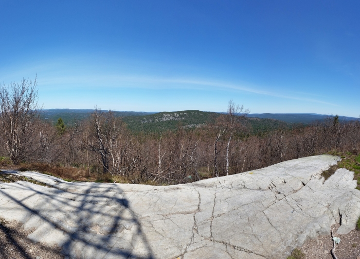 View facing North
I hung out at the top for a while. Ate lunch and found a geocache full of notes from people addressed to other people who are presumably going to hike up to the peak in the near future. After that it was time to throw on the harness and climb up to the top of the tower. The youtube video posted below will have better details of the top. After the climb I hung out in the tower for a bit then climbed down. I took one last look from the top and started on the way back. The descent and bike back was much quicker than the way there. When I got to the last creek crossing I did it all in one shot bike backpack and all.
Please click on the  icon to make the Google map full screen to better see the photos and where the obstacles are. At the peak I took panoramic shots of North, South, East and West.
I don’t know how often I will continue to do this however having a go pro is quite fun so here is a little video of my approach including the drive up. https://www.youtube.com/watch?v=bqZuZ3ov_4k
Stats:
30.3km
1214m of elevation gain
7.5 hours (doesn’t include lunch at top and climb)

Awesome! I’m from Sudbury and had NO IDEA this was so close to home. Thanks for sharing. Sounds like a pretty exciting day. I’ll definitely make sure to bring an extra pair of socks on my trip out 😉
LikeLike
I am impressed with this site, real I am a fan.
LikeLike
Thanks!!!
LikeLike
I appreciate the blog. did you see any wilfdlife, bears, wolves, deer?
LikeLike
Thanks! I saw nothing unfortunately or fortunately depending on what.
LikeLike
Hi Daniel! Awesome job detailing your route and directions on the map above. I am interested in the route you took by car as it wasn’t included. Please could you send me details of the drive? Thanks!
LikeLike
Hi Dominic, Unfortunately gpx/kmz/kml files aren’t supported by wordpress. I have edited the map so if you zoom out it will show the drive. If your curious about the road conditions in 2018 when I did it just watch the video. I apologize for the poor quality of the video.
LikeLike