

On my way to work at Crofters Organic on Oastler Park drive, I drive by the Boyne River. Also, walking along the Rose Point Trail a small section of it crosses the Boyne River. This inspired me to paddle it. I knew I had to do it in high water, so I tried to tackle it as early as I could in the season. I had to do it during the evenings as my April was pretty busy.
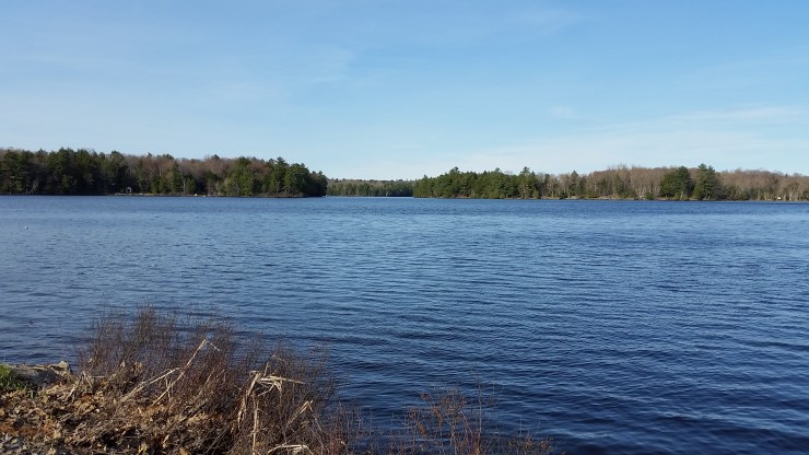
The starting photo right near Oastler Provincial park
Section 1 Oastler Park to Rose Point Trail
April 26th
9.32km
I didn’t start paddling until about 5:30pm. My goal was to do the entire thing in one go but I didn’t know the river and turns out the water level wasn’t as high as I thought. Right before getting to the start of the river I almost flipped under a fallen tree I tried to duck under. From the highway you can see a set of rapids which I had checked out a few days before but with the nice weather we had over the last few days the water level was to low and I had to portage around them. 100m further, people had put a ton of fallen branches down to try and stop the flow or something. This required another short portage. The next kilometer was really cool. There was a culvert to kayak through. After a kilometer you hit the Rose Point Trail and are forced to portage around a very rocky section. From here it was smooth kayaking. The water travels through a nice wooded forest, then a bog of sorts, which I could foresee being terrible to paddle through during bug season. From the bog you go under the second bridge under the Rose point trail which spits you out directly into a small section of rapids which was barely paddle-able. The sun was going down and I knew I still had about 2 hours of paddling so when I hit the last intersection with the Rose Point trail I got out and portaged the kayak back to my buddy Rob’s house where I was going to end anyways.
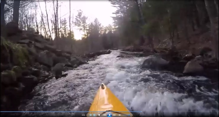
Rapids under the second bridge
Section 2 Rose Point Trail to Georgian Bay Marina
May 15th
5km
I started at the Rose Point Trail were I portaged the canoe to where I left off the other day
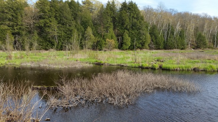 The starting point of section 2
I much preferred this section as opposed to the first section. In high water this whole section is paddle-able except one fallen log near the end. For most of the way there is an obvious hiking trail river right, making the portages pretty easy. Out of the 5km there’s about 300m of portaging to do.
Please click on the ![]() icon to make the Google map full screen to better see the photos and where the obstacles are.
icon to make the Google map full screen to better see the photos and where the obstacles are.
For the paddle I decided to take out the Go Pro I got for Christmas. I’m very new to the whole video editing but check it out at https://www.youtube.com/watch?v=gvCoXRh–cg&t=6s. You might have to copy paste the link into your URL for some reason.
