

The parking for King’s Cove lighthouse Trail is located at 48.569770, -53.332138 off of Top Road. King’s Cove lighthouse trail has it all. Fantastic ocean views as far as the eyes can see or the coast on the other side, almost guaranteed to see whales, waves crashing on the coast, a lighthouse, beautiful geology, the list goes on. The trail is beautifully maintained and easy to follow.
The first half kilometer of the trail is along the coast with beautiful ocean views. This is a great chance to see whales going into and out of the various bays.
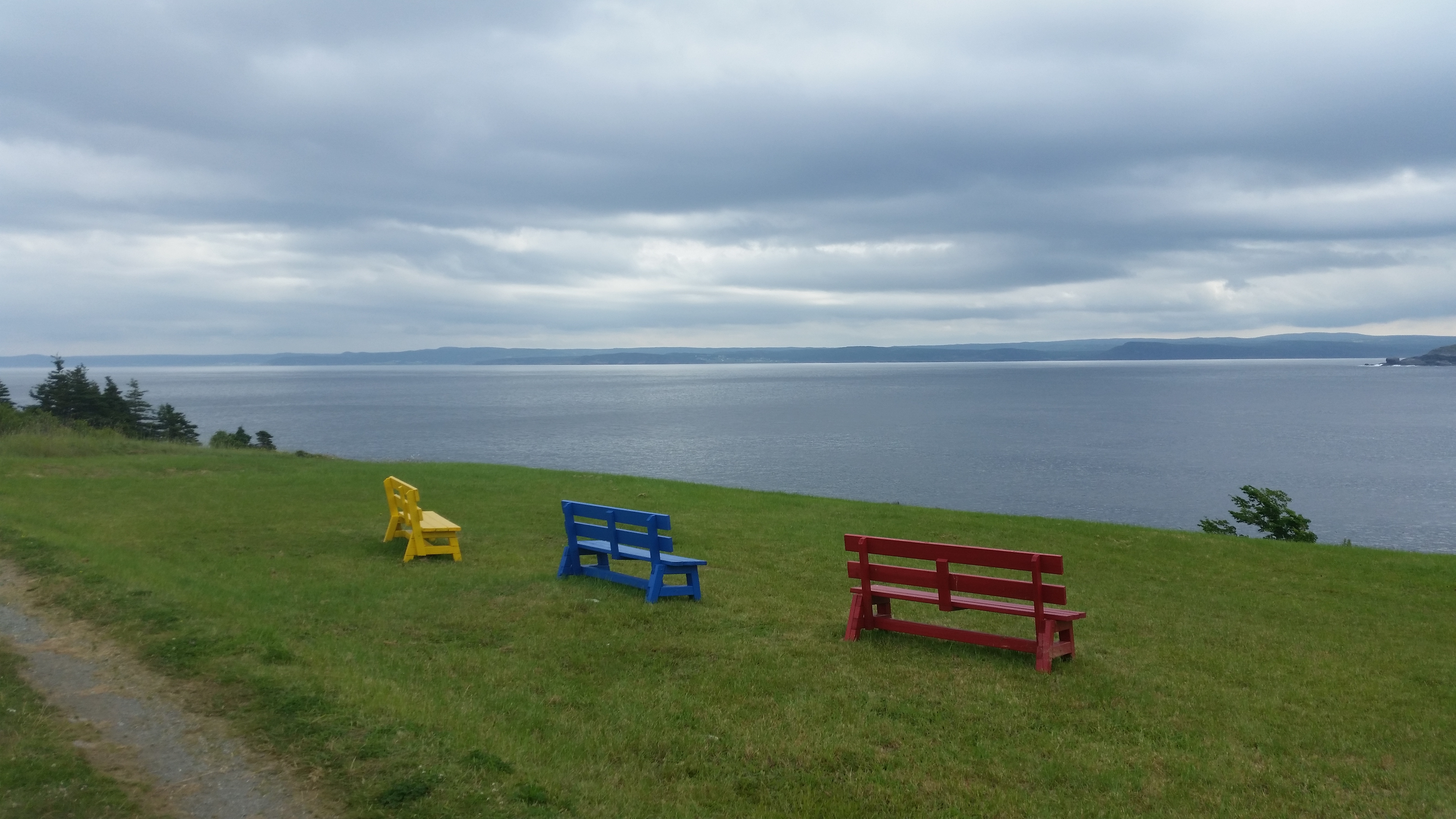 7 km in the distance is Upper Amherst Cove where we stayed.
The next 500 meters is through the forest on a wide atv/truck trail that brings you to the lighthouse. From the lighthouse hike another 200 meters to Fishpoint lookout.
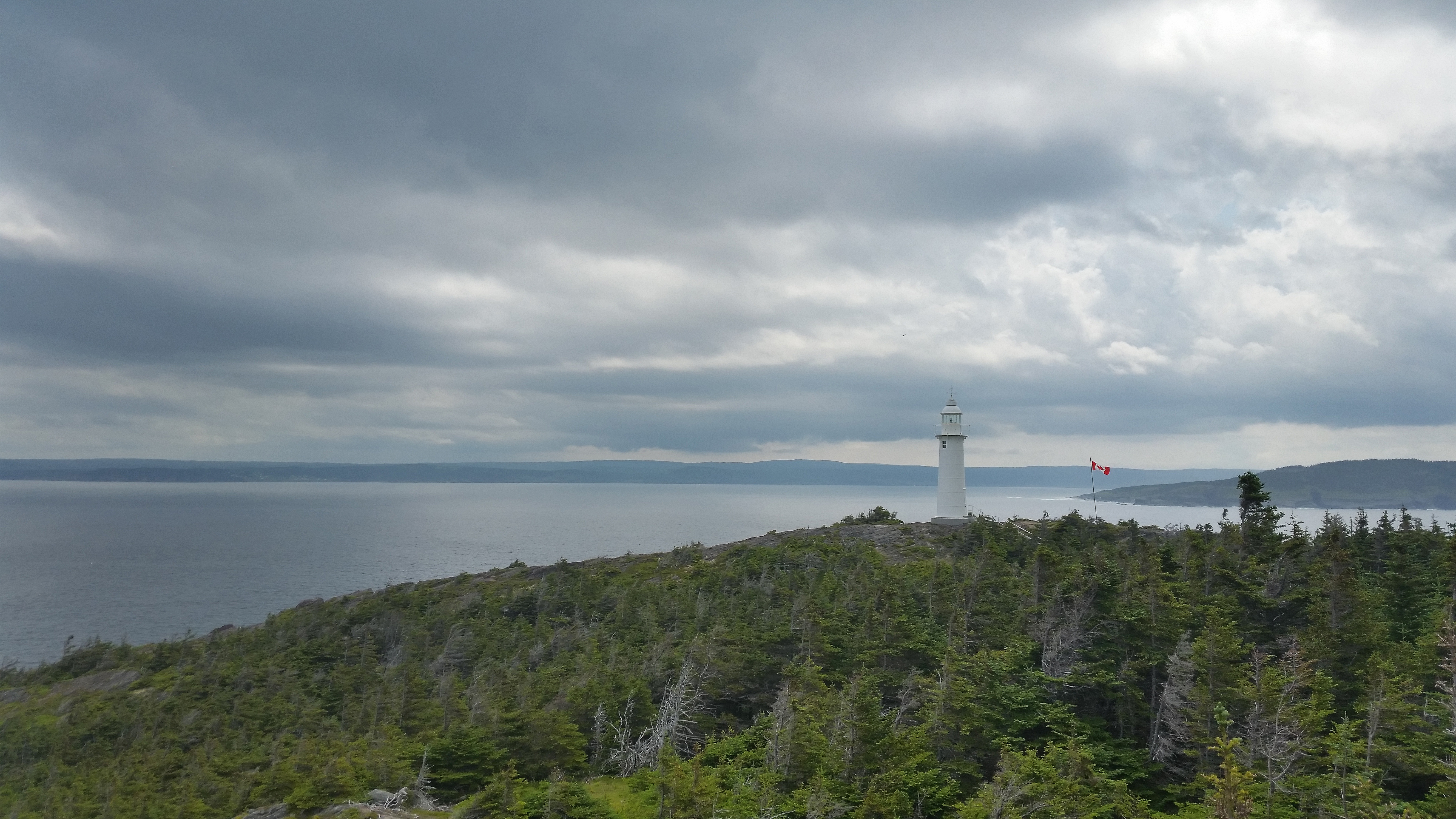 The Lighthouse from Fishpoint Lookout
 The coast from Fishpoint Lookout
After Fishpoint lookout the trail turns into a very well maintained single track dirt trail. 2.1 kilometers in you get to Brook Point.
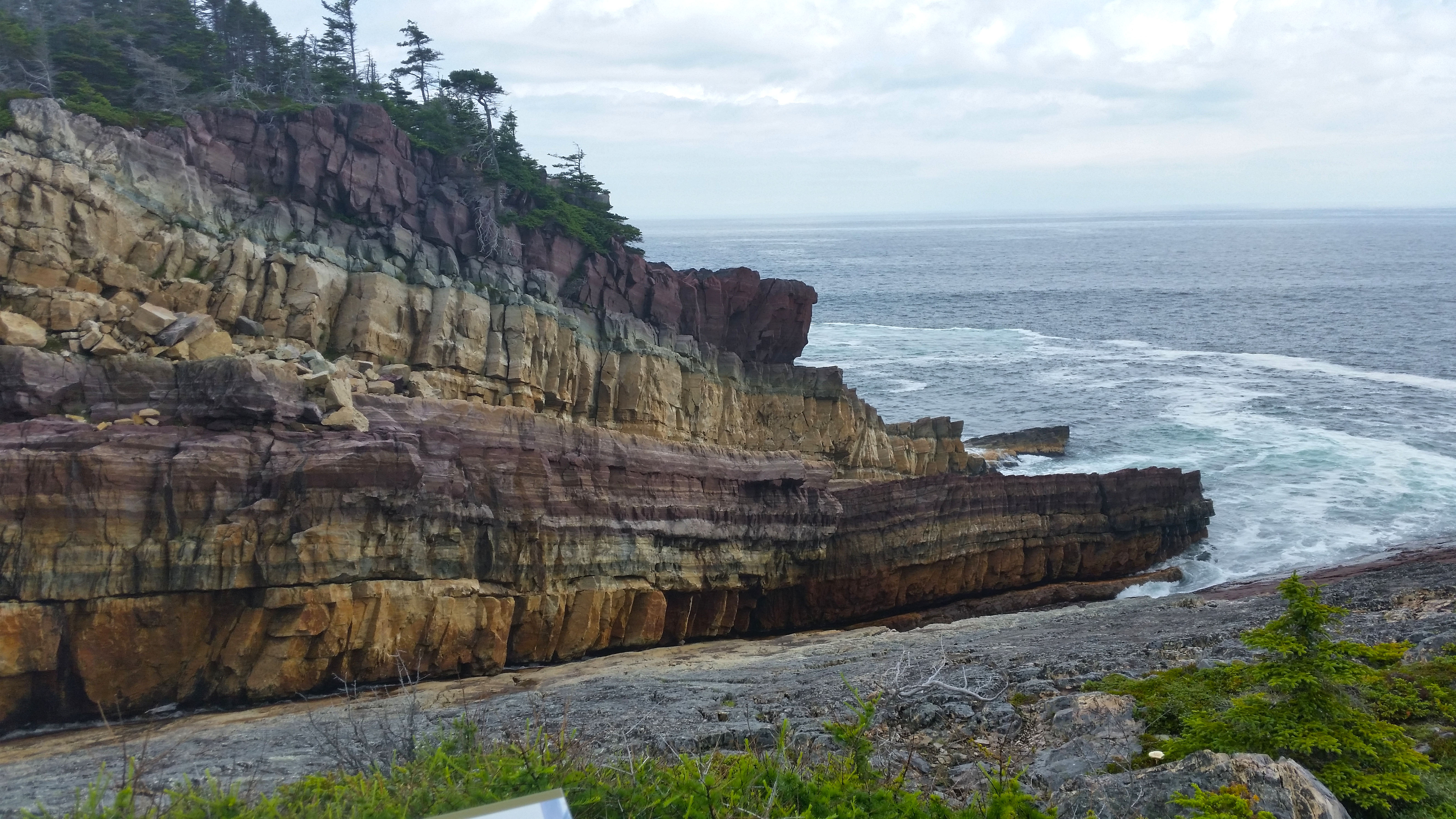 Brook Point, a geologists dream
After Brook Point another 1.5km through dense forest will get you to Whelan’s Hill Lookout. There is a decent climb to the top of Whelan’s Hill.
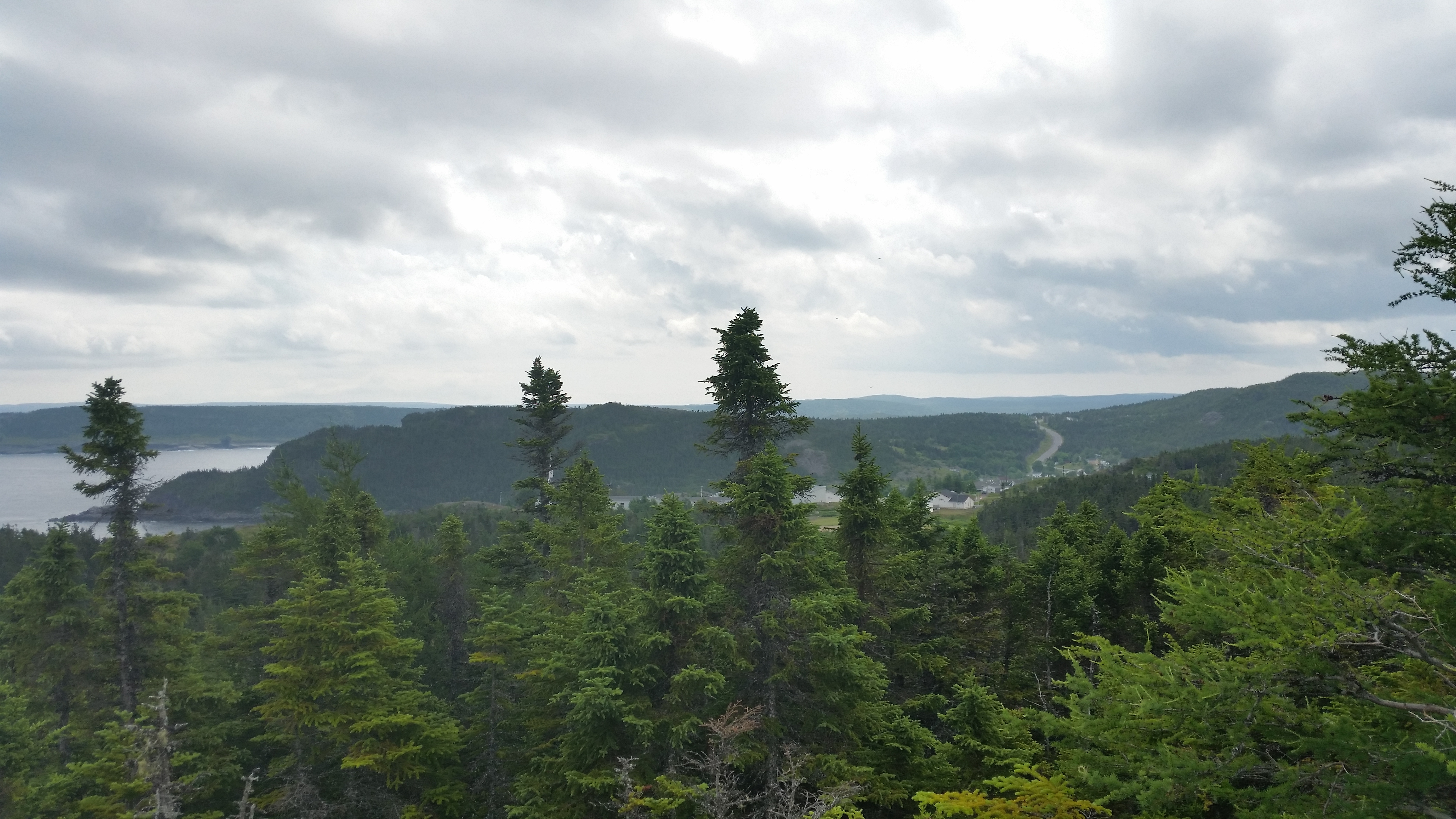 View of King’s Cove from Whelan’s Hill Lookout
The last 800 meters is smooth sailing.
Click on the
 icon to make the Google Map full screen, to see all the photos I took and where they were taken. Click on the
  symbol to see all the photos. There are 12 in total.
Stats:
Total hike: 4.4 km
Elevation gain: 237m
