

Whiskeyjack Lake and Limestone Islands Provincial Park are the coolest places I visited this year.
La Cloche Silhouette trail is a 80 km hike around Killarney Provincial Park. The most popular section of it being “The Crack” hiking trail. This is a 4 km section of it (8 km round trip).
 Top of “The Crack”.
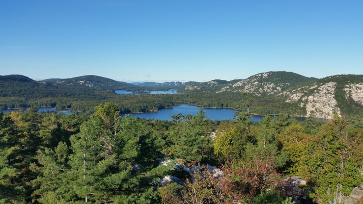
What the trail maps and guide books don’t tell you is that the trail only gets more scenic from there. Heading east after “The Crack” rewards you with National Geographic front page photo landscapes. 1.5 km further there’s an opening where the Silver Peak Range (tallest peak in Killarney Provincial Park) becomes visible.
 Silver Peak Range in the distance. The closest lake is Little Superior Lake.
The trail is very well marked, but sometimes the blue trail blazers are easy to miss. Often times there’s a lack of cairns to follow when the trees are scarce. Before getting to Little Superior Lake there are three little peaks that you have to hike up and down. One of them offers a great view of Philip Edward Island.
 Facing South, Georgian Bay about 10 km in the distance.
6.5 km of hiking, I got to Little Superior Lake. There’s a campsite on this lake but I didn’t see anyone there.
 Little Superior Lake.
Only a few hundred meters further is Proulx Lake.
 Proulx Lake.
From Proulx Lake there is a decent climb on a fairly exposed cliff. This offers great views of Kakakise Lake and Georgian Bay
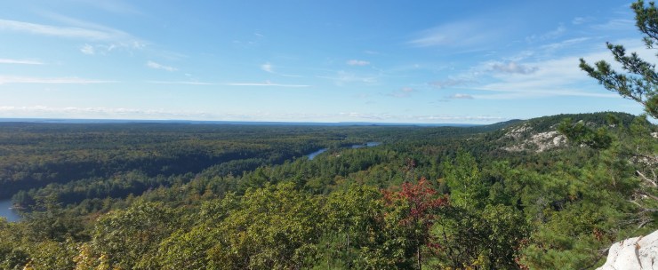 Facing South, Kakakise Lake in the distance, Georgian Bay even further.
After 11.1 km I reached Heaven Lake. The name of the lake is an unofficial name given because the lake has the highest elevation in the park and the views of Georgian Bay just south of the lake.
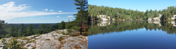 Left: View of the bay Right: Heaven Lake
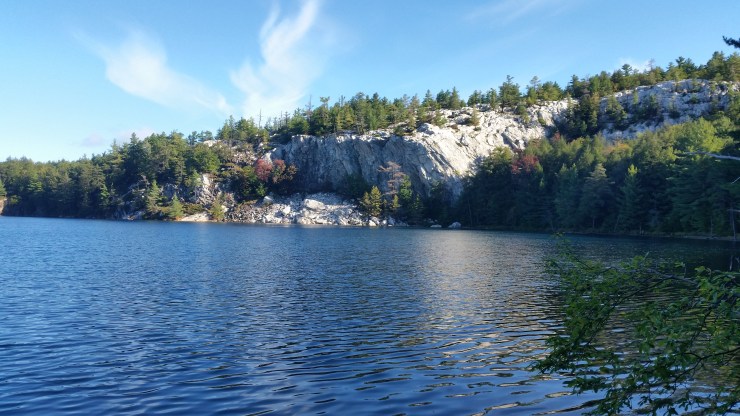
400 meters further along La Cloche Silhouette and a 300 meter bushwack latter I arrived at Whiskeyjack Lake. This is the clearest lake in the Park.
 Whiskeyjack Lake
This is an awesome spot to spend the day! If your hiking the whole La Cloche Silhouette trail reserve a couple hours to spend here. Swimming in this lake is unreal. I swam with a rock and dropped it. You could see it fall the entire way and when it finally hit the bottom it looked like you could just reach down and touch it even though it was probably 50 feet deep. Here is a video of me swimming in the lake. https://www.youtube.com/watch?v=Pgn8e5KWb7M
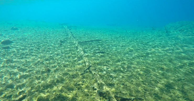 A photo taken from underwater to show the clarity!
The hike back was equally enjoyable. I ran into a few people starting out the La Cloche Silhouette loop. When I got to “The Crack” there were hundreds of people. So I decided to run back to the car. The parking lot was crazy. If you plan on hiking “The Crack” I’d arrive early if you want some piece and quiet.
Stats:
23.7 km
902 m elevation gain
