

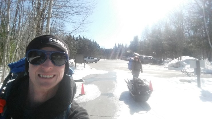
 First day selfie.
In 2016 Josée and I were looking to go yurt camping in a provincial park. Unfortunately by the time we were interested everything was all booked up. November 13th 2017 we were able to book the last of six yurts in Killarney Provincial Park for the nights of March 3rd and 4th. They require a minimum two night stay.
March 3rd 2018
Unfortunately this winter, we received next to no snow after December so everything was very icy. We checked in, then tobogganed our stuff to our yurt.
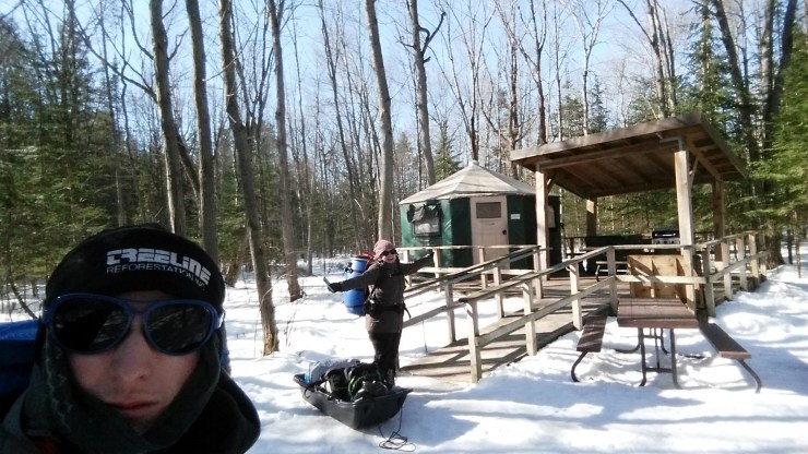 Arriving at the yurt.
From the yurt we went to the Cranberry Bog Trail.
The Cranberry Bog Trail is an awesome loop trail. Parking in the summer is at the beach. The trail starts off with a great view of the bog.
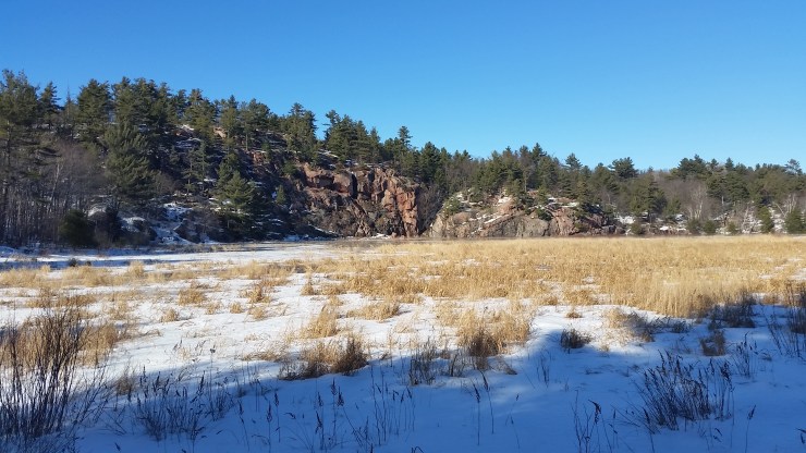 View of the bog.
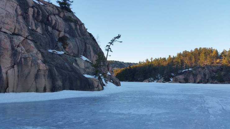
The trail was very icy. So any chance we got, we would sit down and ride down the hills. There was a very steep section that I had to pull out my knife to make foot holds in. Three kilometers in there is an awesome view of A.Y. Jackson Lake.
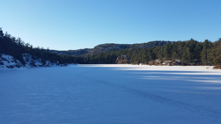 A.Y. Jackson Lake.
From A.Y. Jackson Lake there’s a steep uphill to the top of the cliff you see in the first photo and then a steep downhill back down to the campground.
March 4th 2018
We woke up, made breakfast and drove to the town of Killarney to hike the Tar Vat Bay Trail. The Tar Vat Bay Trail is a coastal point to point trail with great views of Georgian Bay. The trail is slightly difficult to follow. There are either white trail blazers or cairns guiding your way. 1.2 km in there is a wicked view of the bay.
 View of Georgian Bay. The small islands in the distance are 5 km away.
From here the trail was very open with hardly any snow. 2.1 km in we got to Tar Vat Bay.
 Tar Vat Bay.
The town of Killarney used to be a very successful fishing town. Before the invention of nylon the nets were made of cotton. Cotton was not very durable so covering cotton nets in tar became part of a fisherman’s usual practice.
Tar Vat Bay is supposed to still have the aroma of tar left over from the 1950’s. There’s also supposed to be some relics of the past. However, we came in the winter and most likely they were all covered in snow (along with the smell). The smell of petroleum wasn’t on my bucket list so I’m glad that wasn’t apart of our hike.
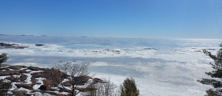
The hike back was fairly uneventful until we got to the car. I decided to hike about 50 meters the opposite direction of the trail and got a stunning view of the bay. This is were I took the feature image at the top of the blog.
We spent the rest of the afternoon in Killarney having lunch and walking around. We got back to the yurt played some board games, had dinner then I decided to go for a walk on George Lake.
 A lonely tree only a few hundred meters from the beach.
A kilometer later a great view of the Killarney Ridge.
 Killarney Ridge.
On the way back I watched two deer graze on trees for about 10 minutes before heading back. I was only able to get blurry photos with my zoom and I didn’t want to startle them by getting to close.
March 5th 2018
We woke up had breakfast, packed our bags then headed out. Before heading back home we hiked the Granite Ridge Trail.
Still no powder, just ice. Five hundred meters into the hike there is an old car; remains from the old Tyson homestead. The car predates the highway and had to be transported from Manitoulin Island by ice in the winter.
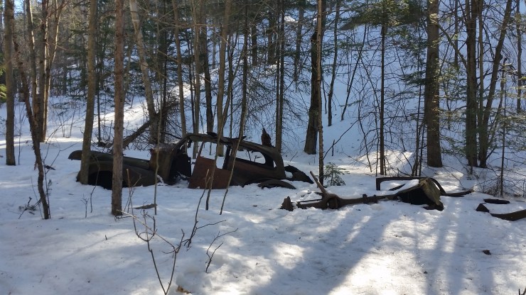 Old remains of a car owned by the Tyson homestead.
At the ~700 meter mark the trail starts to get pretty steep, and maintains this steepness for the rest of the loop until it doubles back to the ~700 meter mark. At kilometer 1.5 and 1.6 there are two great views. The first view is a view of Killarney and the Silver Peak Range.
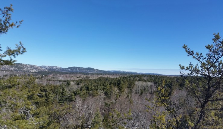 Silver Peak Range.
 Georgian Bay from the top of the Granite Ridge Trail.
The hike back was just as painless as the rest of the trail. Just a few icy sections.
For those who would like an easy introduction to winter camping this is the way to go. We had a great trip and have decided that there is very little chance either of us will do real winter camping. The luxury of sleeping in a heated interior is to hard to give up.
Click on the  icon to make the Google Map full screen, to see all the photos I took and where they were taken. Click on the
  symbol to see all the photos. There are 21 in total. I colour coded each hike: blue for Cranberry Bog Trail, purple for Tar Vat Bay Trail, and yellow for Granite Ridge Trail.
Here’s a video of the trip: https://www.youtube.com/watch?v=sUxfIjF7PH8&
Stats:
Cranberry Bog Trail: 3.5 km hike 76 m elevation gain
Tar Vat Bay Trail: 4.3 km hike 100 m elevation gain
Granite Ridge Trail: 2.8 km hike 58 m elevation gain
