

Today my goal was to complete the rest of the day hiking trails in Algonquin Provincial Park on the 60 corridor.
Lookout Trail: This trail is the most popular trail in Algonquin Provincial Park. The trail is only 1.9 kilometers long and has been manicured to make it as easy as possible. One kilometer in there is an awesome view of the park. The photo at the top of the page is the view from the trail.
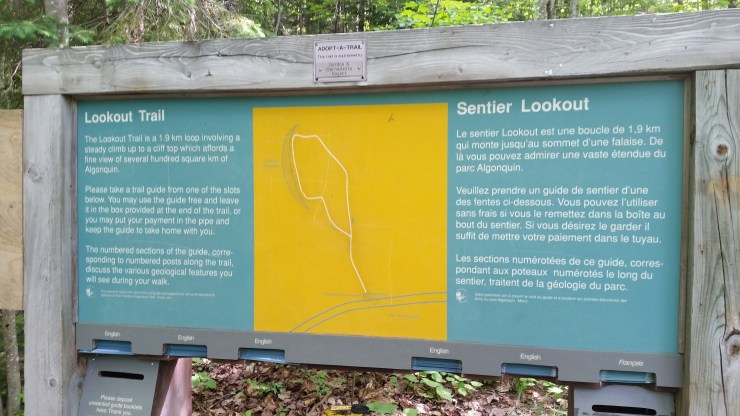 Trailhead photo.
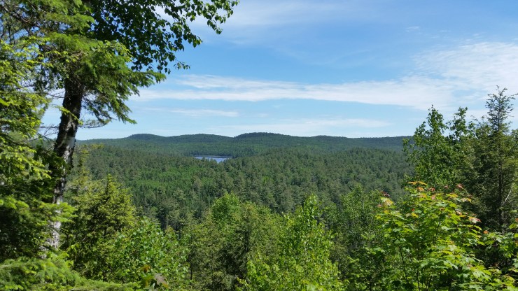
Two Rivers Trail: This is a nice 2.4 kilometer loop trail that meanders through the forest. There are two decent lookouts where you can hear the river flowing in the valley below.
 One of the lookouts 1.6 km in hiking counterclockwise.
Bat Lake Trail: I was very surprised by the beauty of this loop trail. I hiked the trail clockwise which I would suggest. There is a really nice stream 1.3 kilometers in. 1.9 kilometers in there is a really cool rock that seems like it is on the verge of falling over and rolling down a hill.
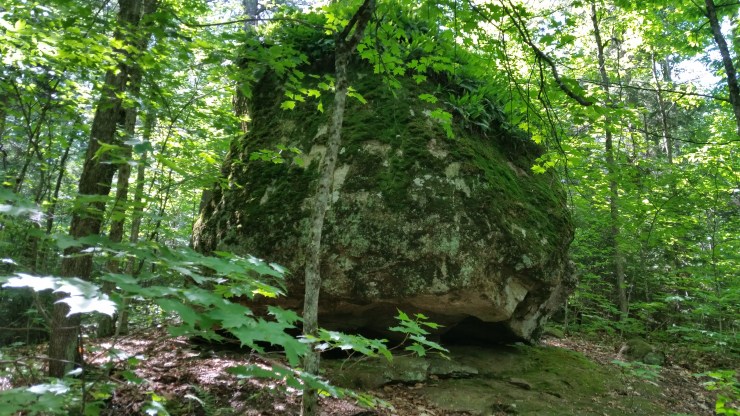 Balancing rock.
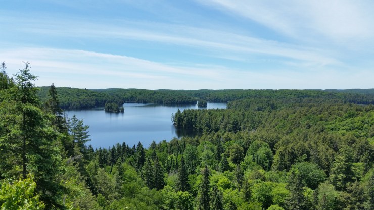
2.6 kilometers in there is a nice lookout of an unnamed lake.
 Lookout on Bat Lake.
From here the trail goes over a series of boardwalks to Bat Lake and then ends back at the parking.
Track and Tower: This is a picturesque 7.8 km trail. I highly recommend starting this trail early because it gets crowded around lunch time. Despite it’s length this is a quite easy trail. The hardest part is near the lookout where the park has built a staircase.
 Lookout over Cache Lake.
The last bit of trail goes over the old railway through Algonquin park.
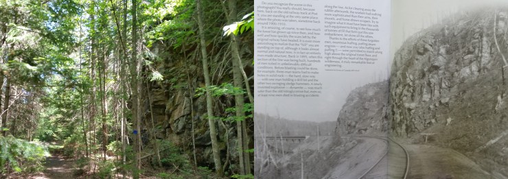 Today and an old photo of this same site taken between 1900-1910.
Mizzy Lake Trail: This is a 11.4 km trail with an optional 2.5 km side trail. This trail runs through 9 ponds/lakes. The trail is very well maintained with tons of boardwalks. Watch your feet along the trail because there are tons of roots sticking out waiting to grab your foot. Although the side trail was closed I decided to do it to be true to the trail. This trail is supposed to offer the best chance of seeing wildlife along hiking trails in the park. However, I was unlucky and did not see anything.
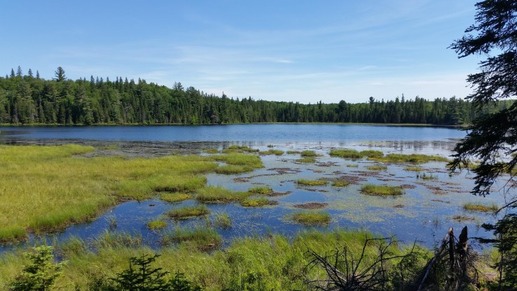 March Hare Lake
Whiskey Rapids Trail: This 2.1 km trail is not worth your time in a hot summer. The rapids had pretty much ran dry by June 16th this year.
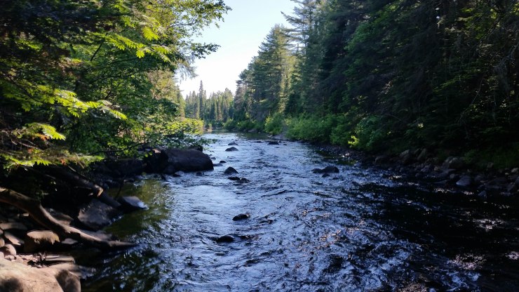 Whiskey Rapids.
Click on the  icon to make the Google Map full screen, to see all the photos I took and where they were taken. Click on the
  symbol to see all the photos. There are 21 in total. I colour coded each hike: blue for Lookout Trail, purple for Two Rivers Trail, brown for Bat Lake Trail, green for Track and Tower Trail, yellow for Mizzy Lake Trail, teal for Whiskey Rapids.
Stats:
Lookout Trail: 1.9 km 74 m elevation gain
Two Rivers Trail: 2.4 km 154 m elevation gain
Bat Lake Trail: 5.5 km 212 m elevation gain
Track and Tower: 7.8 km 276 m elevation gain
Mizzy Lake Trail: 13.9 km 666 m elevation gain
Whiskey Rapids Trail: 2.1 km 82 m elevation gain
Here is a little video I put together of the popular view points: https://www.youtube.com/watch?v=35y7bCpQwQ8
