

The Shebeshekong River runs from Shebeshekong Lake and ends in Georgian Bay. This is a perfect full day paddle or a great two day trip. The water levels drop very quickly after the spring melt. This river cannot be paddled when the water levels are low.
We started off in the morning by dropping our cars off at the end of the river. You can park on Dillon road at the Dillon rapids located at 45.436863, -80.316911. There is a turn off that fits a few cars. Or you could purchase a parking pass at Dillon Marina located at 45.426564, -80.325805. We then drove to the beach on Shebeshekong Lake located at 45.452870, -80.196596.
For a video of the first section: https://www.youtube.com/watch?v=jWHVeXdPXr4
We starting out paddling at 09:30. The morning was cloudy until 10:30 then it cleared up for a beautiful sunny day. We paddled north on Shebeshekong Lake paddling thru a culvert. There was very little current to the river. Our first of many portages was 2.5km in (Portage #1). A very small boat could fit under the bridge. Meandering through the twist and turns of the river at 3.6km we hit a beaver dam (Portage #2). The river flows under a bridge then shortly after at km 4.1 another beaver dam (Portage # 3). At km 5.0 we hit Mazur Lake. This is when the clouds disappeared.
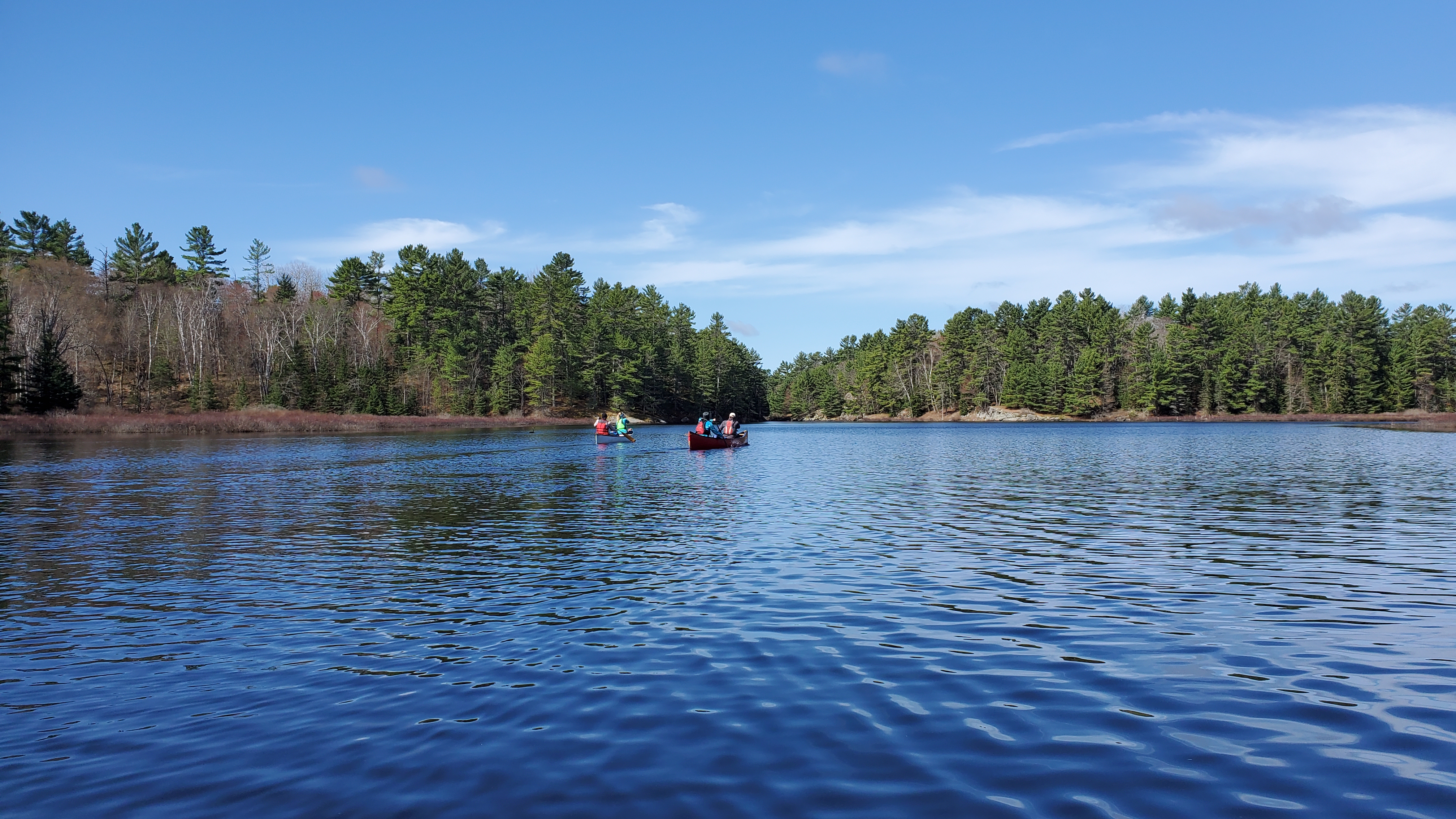 It was a very calm morning. At the end of Mazur Lake there is a small set of fast water. Class 1 if that. At km 6.6 we reached a fairly high up beaver dam (Portage #4). We had to walk around in the tall grass rather than a simple lift over. I wasn’t thinking and only wore shoes so I got very wet. I would wear rubber boots next time.
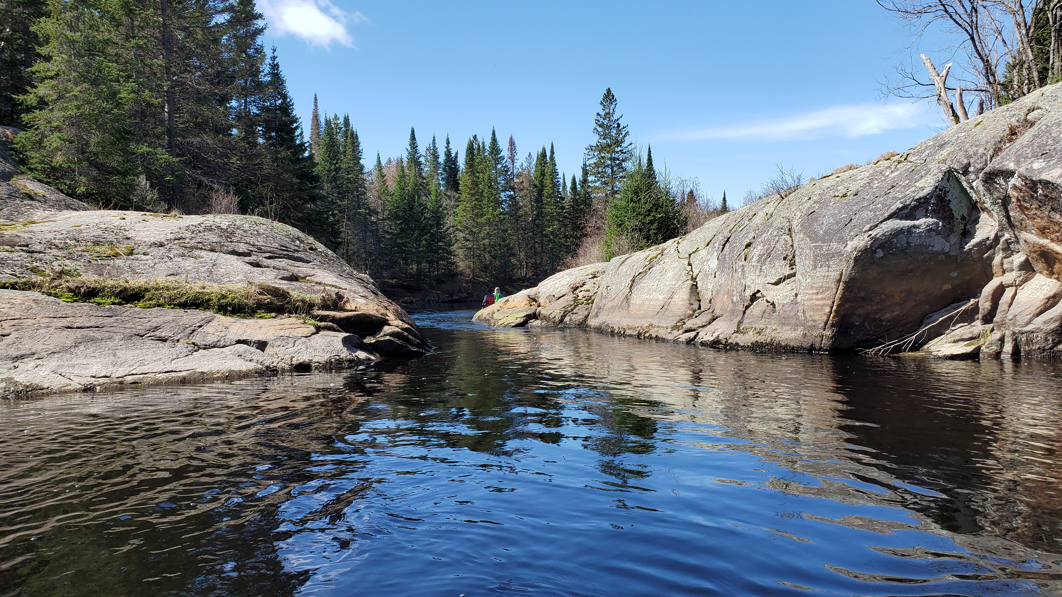 At km 7.9 we came to this really cool cut out in the rocks. For the next kilometer or so the river was constantly turning. At km 10.6 there was a fallen over tree that I attempted to trim with my saw but my saw just couldn’t get thru it. We had to portage around it (Portage #5).
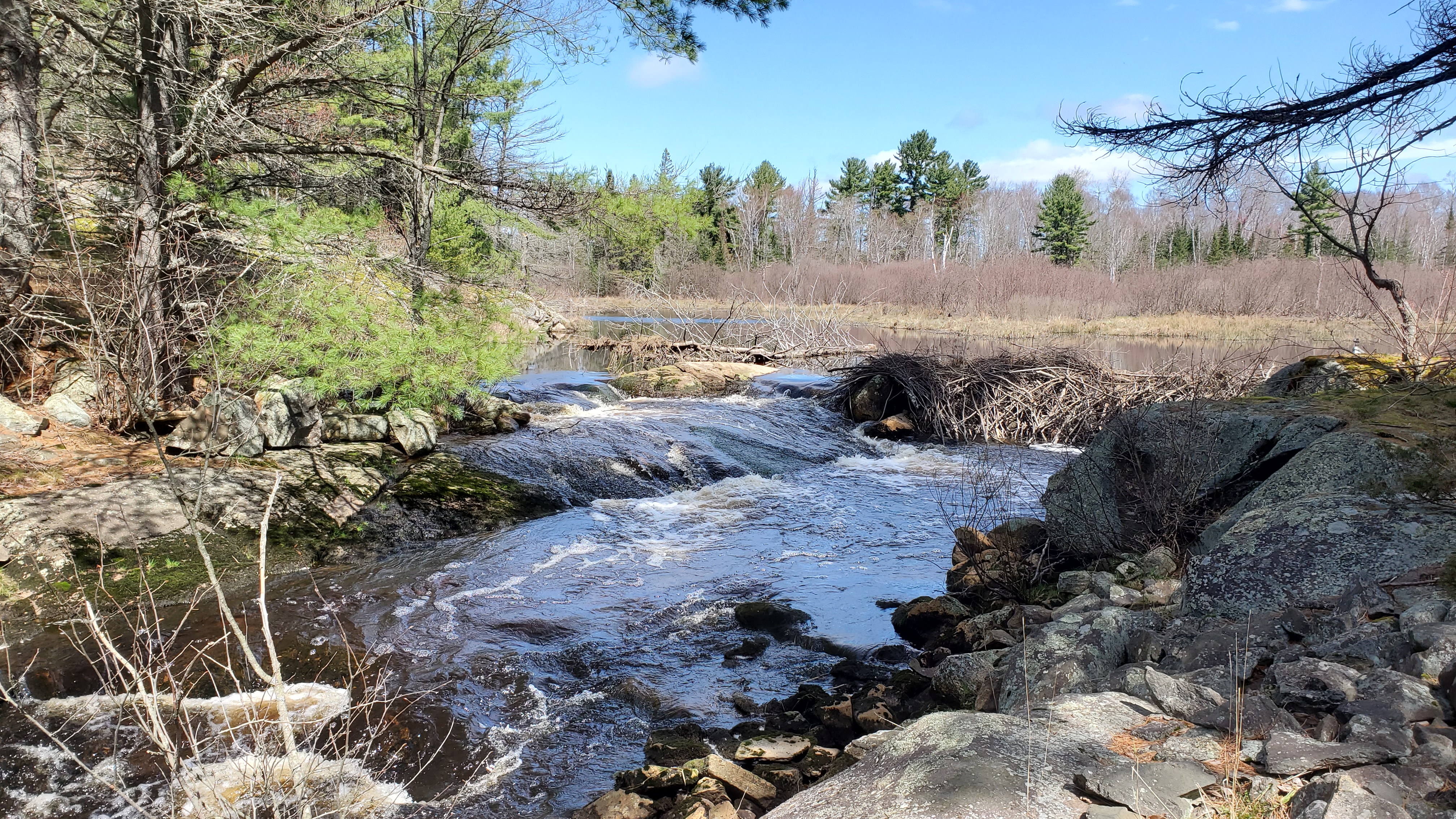 Km 12.5 the rapids were too low to run. There was a 40 meter portage here (Portage #6). Just 400 meters downstream we hit a very rocky section that we had to portage around (Portage #7). The next 6km of the river along with little Shebeshekong Lake is all crown land. Corey and Katrina are much stronger paddlers than us and were a few hundred meters ahead. At km 14 the river looks like it flows south so we started paddling in that direction until we saw them paddling towards us telling us to turn around. We should have headed north. In the next 1.5km we passed two empty campsites river right.
  At km 15.5 another beaver dam (Portage #8) and the only group shot I got the entire day. We paddled across little Shebe to this beautiful campsite where we took a break to have lunch at 1:45pm. I took out the drone and here is a short video of Little Shebe and Corey and Katrina paddling: https://www.youtube.com/watch?v=YPwjX2huL0o . I also shot the feature image from here.
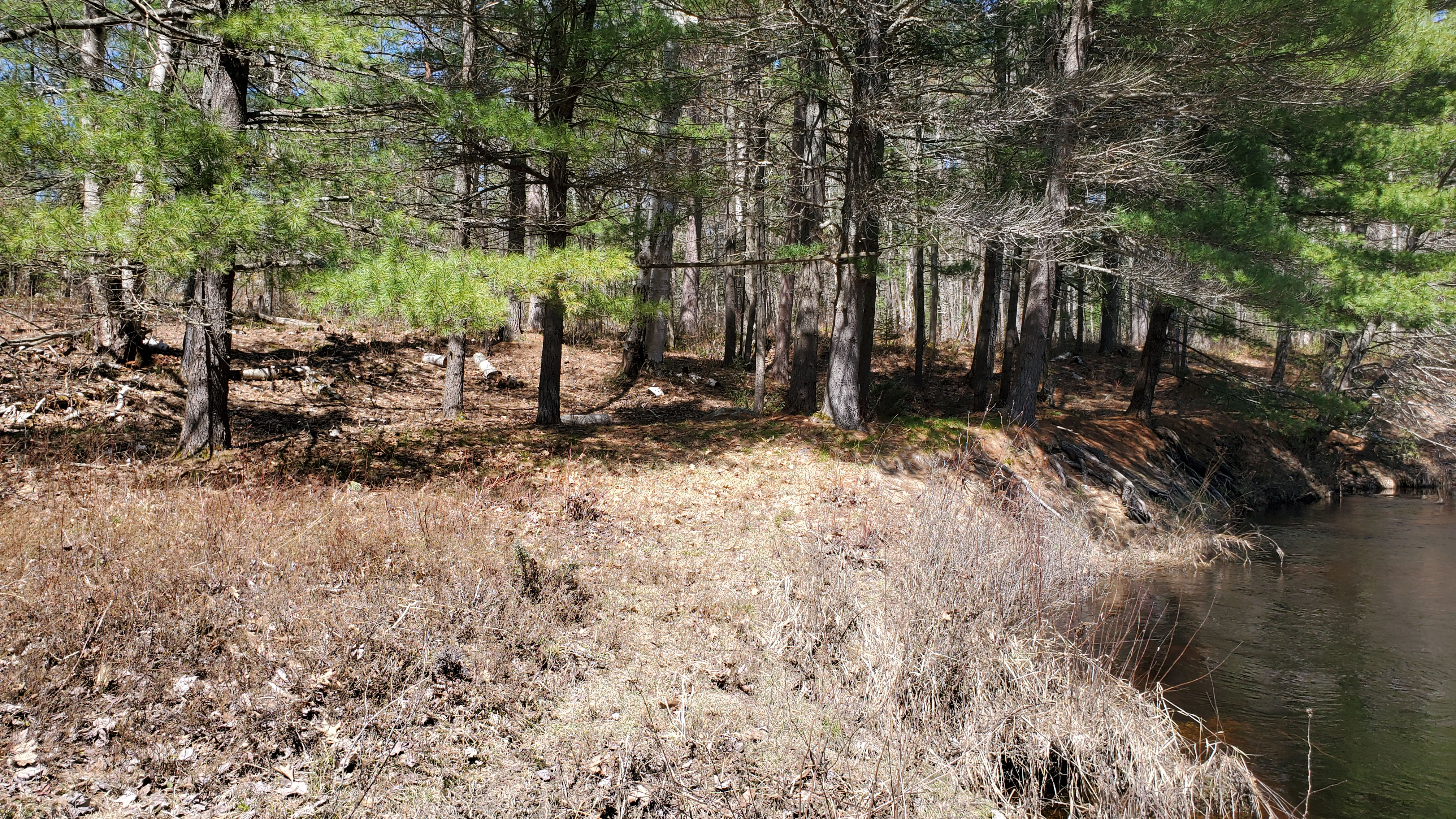
Here is a video for the next section after lunch: https://www.youtube.com/watch?v=Og0AI2PoJ5A
From the campsite at km 16.9 we continued just 500 meters to two fallen tree 50 meters apart from each other. We were able to sneak under one but had to portage around the other (portage #9).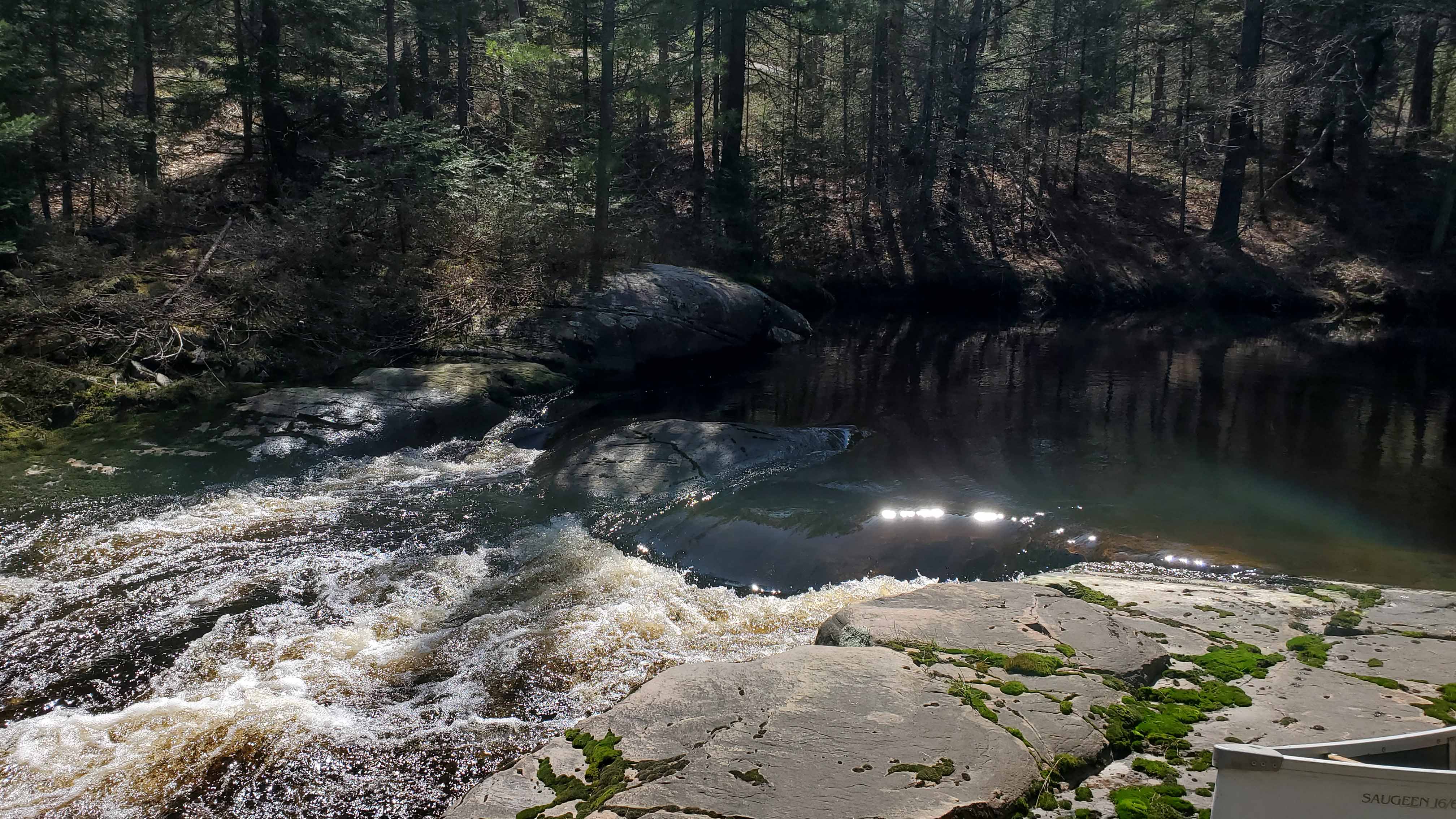 The next set of rapids was at km 17.9. It looked like a soaker so we portaged (Portage # 10). From here there were 3 sets of very rocky class 1 rapids. One at km 18.2 (Portage # 11).
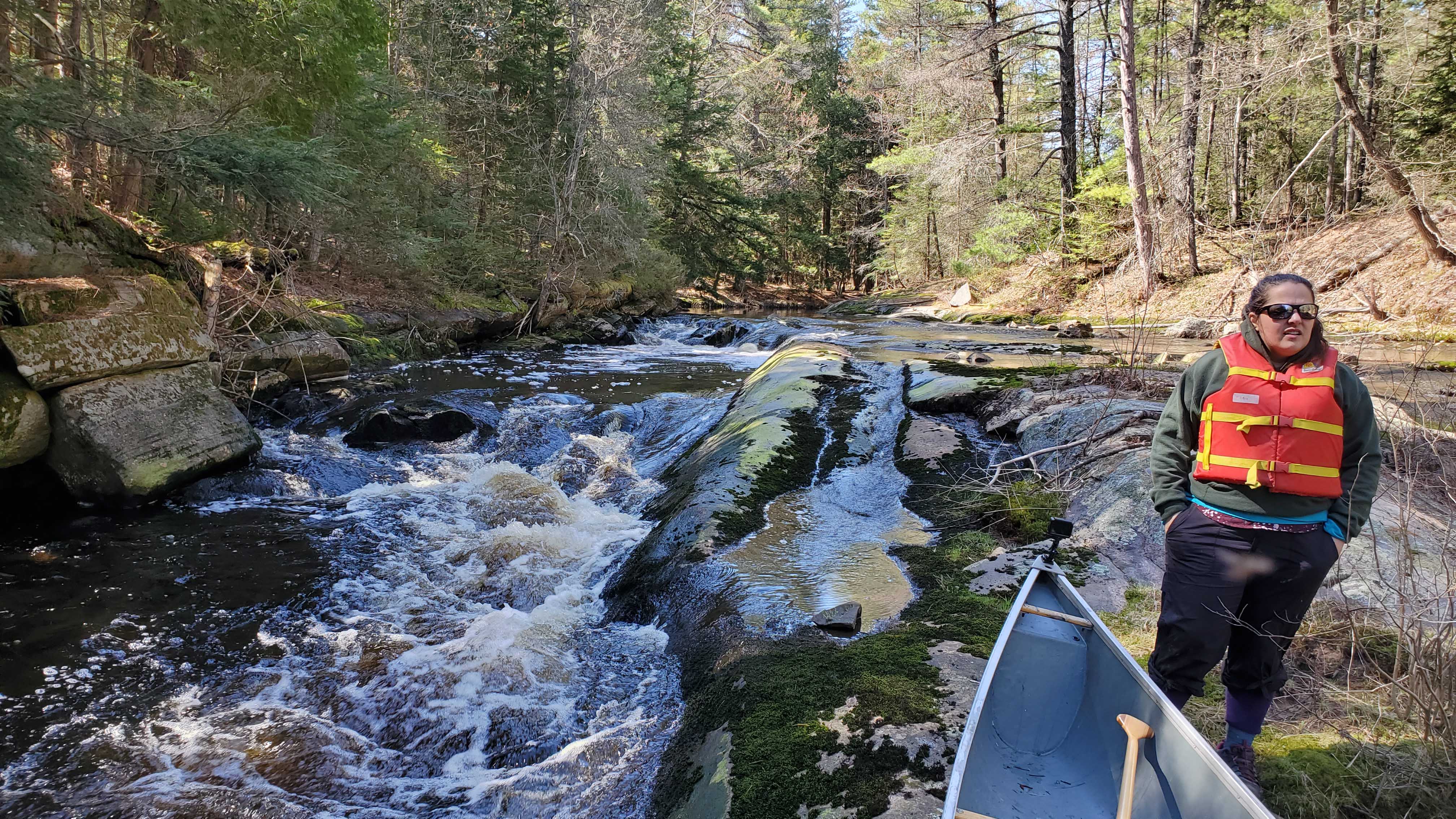 Above is a photo of the rapids at km 18.7. The third set was at km 18.9. We portage around both sets at once following an ATV trail river right (Portage #12). After this third set of rapids the water levels dropped a little bit and we got hung up on a few sand bars in the middle of the river. Dead heads became quite common for the rest of the trip. At km 20.2 there was another fallen tree that we portaged around (Portage #13). At this point the forest faded in the distance and we were then paddling through wetland.
 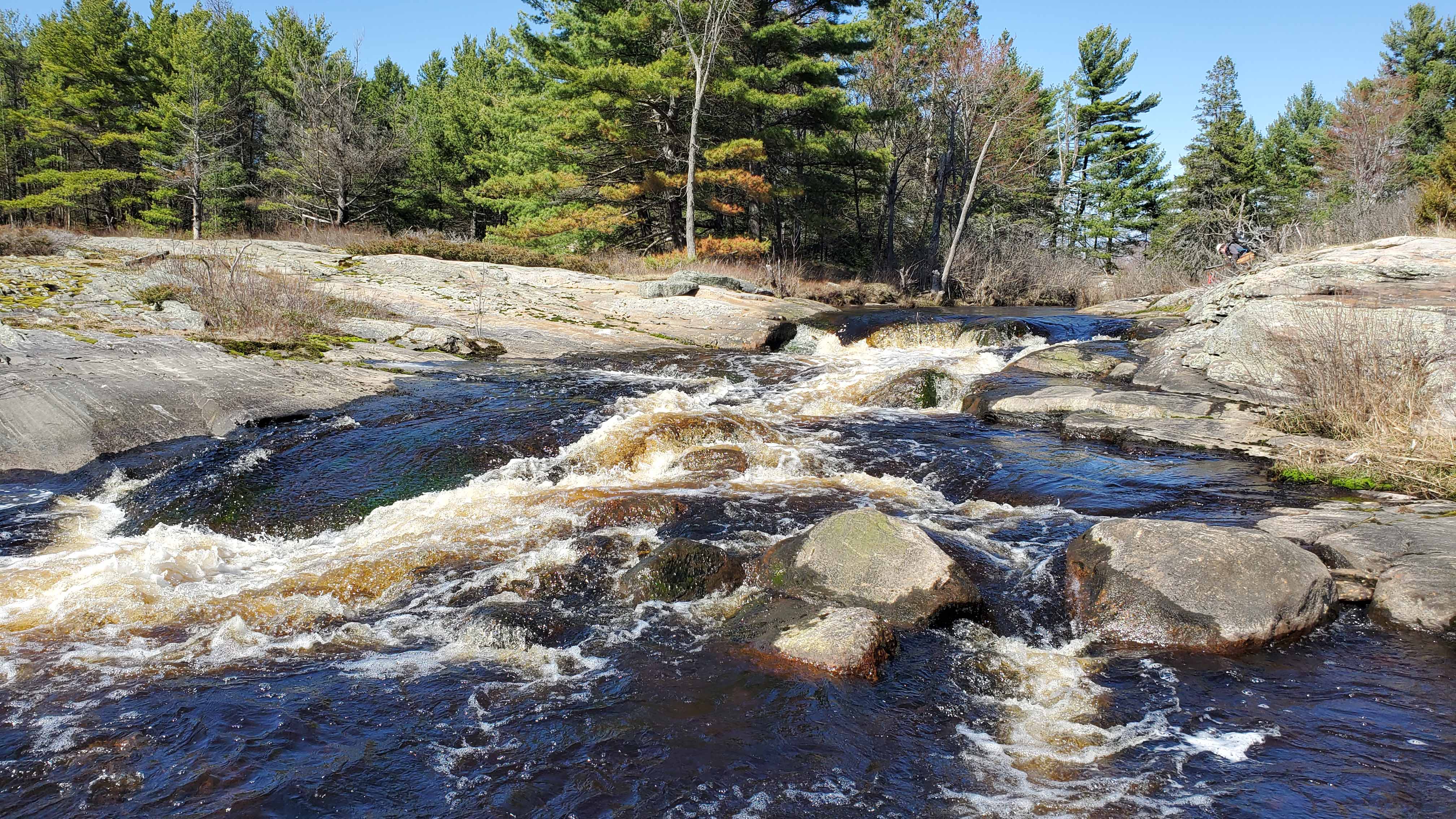 At km 21.6 we hit Young’s Rapids. It was too rocky to attempt (Portage # 14). From Young’s the river widens and straightens out. At km 23.1 we hit our final portage! The portage around Dillon rapids is easier river right (Portage #15). From here it was home free to Georgian Bay. We paddled to the opening of the bay on Fairfield Island. There is a very nice campsite here on crown land.
 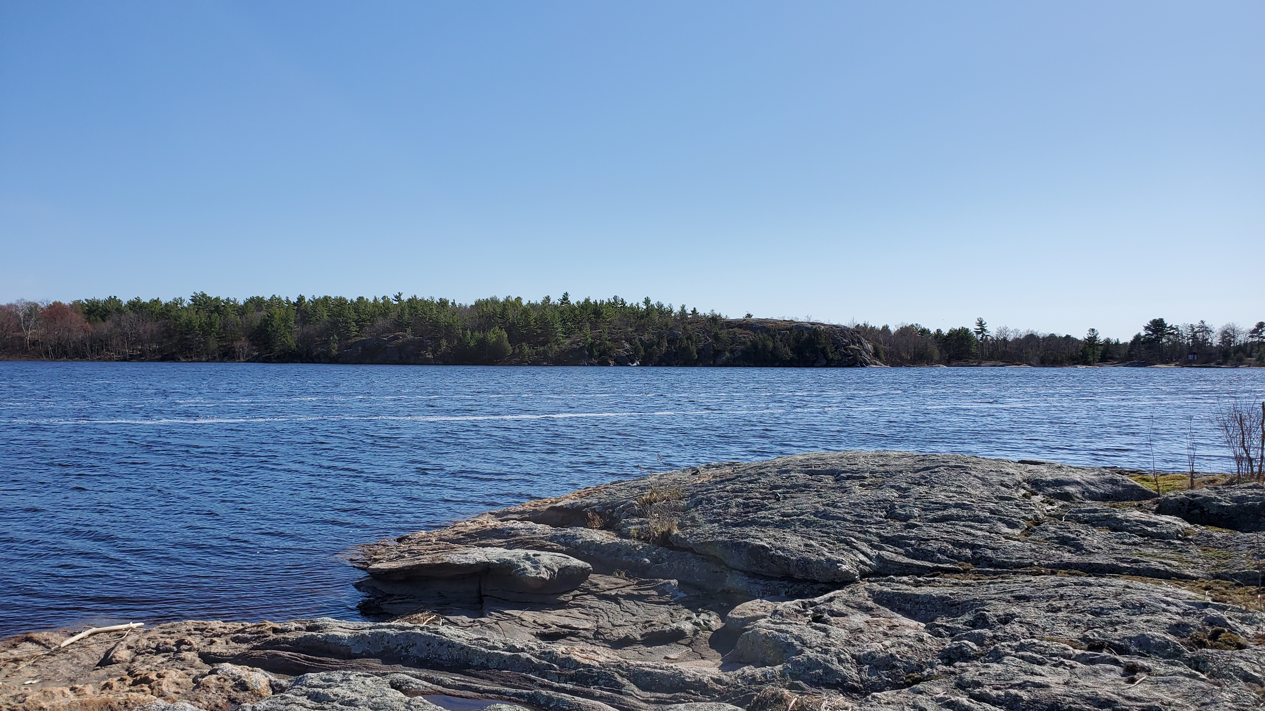 This river has been on my bucket list for a couple of years and it’s awesome to say I’ve finally paddled it from start to finish. The company was great but the river was just slightly too low. We thought April 17th would have been early enough in the season. I would do this trip again earlier in the year and in two days, spending a night on Little Shebeshekong Lake.
Click on the ![]() icon to make the Google Map full screen, to see all the photos I took and where they were taken. Click on the
icon to make the Google Map full screen, to see all the photos I took and where they were taken. Click on the ![]() symbol to see all the photos. There are 23 in total. I also highlighted in yellow some crown land spots. I wasn’t exact with the crown land boundaries to guarantee if you camp in the highlighted areas you are on crown.
symbol to see all the photos. There are 23 in total. I also highlighted in yellow some crown land spots. I wasn’t exact with the crown land boundaries to guarantee if you camp in the highlighted areas you are on crown.
Section 1 video: https://www.youtube.com/watch?v=jWHVeXdPXr4
Section 2 video: https://www.youtube.com/watch?v=Og0AI2PoJ5A
Drone video: https://www.youtube.com/watch?v=YPwjX2huL0o
Stats:
25.6km paddle
15 Portages approx. 300 meters of portage/lift over
