

May 3rd 2018
After work I decided to check out a few waterfalls. The first one is just a small dam off of McDougall Road. It is located at 45.361763, -79.966465.
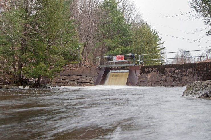 Haines Lake dam
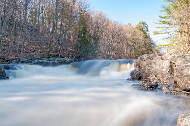
The next set of falls is located at the back end of Deer Run Golf course. I talked to the owner and he said I could check them out. They are located at 45.411973, -79.955980.
 Falls off the Manitouwabing River
From here I drove to Broadbent to get a shot of an awesome set of falls. They are located at 45.468842, -79.826765 and can only be accessed by water or asking the owner of the property.
 Broadbent Falls.
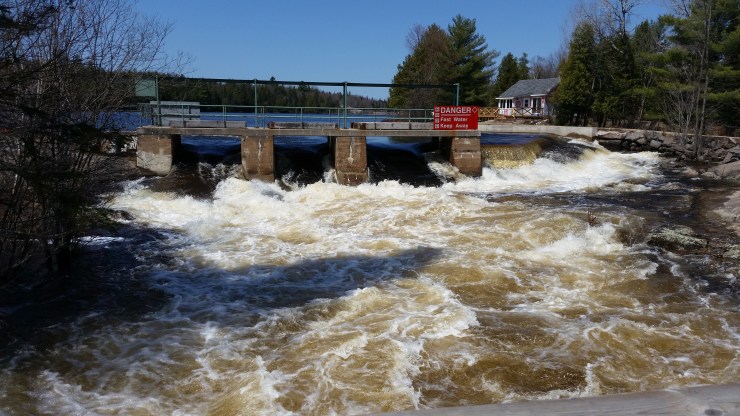
There is another small set of falls located at 45.465764, -79.829277 which weren’t worth photographing. From here I went to the Hurdville Spillway located at 45.441354, -79.921215.
 Hurdville Spillway.
May 5th 2018
The first stop was Feighan Falls. These falls are controlled by a dam and are located at 45.667433, -79.741119.
 Feighan Falls
Just a kilometer up the road is Knoefli Falls. These falls were just roaring. I had a really hard time getting a decent shot with long exposure times. These falls are located at 45.666278, -79.721651.
 Knoefli Falls.
The Poverty Bay Chutes were next on my list. The chutes are on the Magnetawan river near Magnet road. There is a portage that I was able to get a photo of the chutes from. The portage is from river left.
 Poverty Bay Chutes.
From here I went to the Magnetewan locks. They are located at 45.665082, -79.641237.
 Magnetewan locks.
The Stirling Falls is a really small set of falls off of North Horn Lake Road. They are located at 45.682909, -79.431484.
 Stirling Falls.
The Burk’s Falls are just a dam. They are located at 45.619857, -79.411472.
 Burk’s Falls.
May 7th 2018
A friend of mine was telling me about when the township shut down the Hurdville dam for repairs, and he hung out in these three pools off the Manitouwabing River. With permission from the owner, I went back to the golf course and hiked through some woodland. They are located at 45.403692, -79.962339. Without a drone it’s impossible to get a good photo of the 3 pools. The other access to these falls is by parking where McDougall Rd meets the Seguin River and paddling west on the Seguin then North up the Manitouwabing.
 Three pool falls.
Click on the  icon to make the Google Map full screen, to see all the photos I took and where they were taken. Click on the
  symbol to see all the photos. There are waterfalls not covered in this blog post. This is an on going project.
Here is a video of 9 of the falls: http://www.youtube.com/watch?v=0tvFJDJXiY8
