

After checking out the abandoned steam boiler off the Seguin Trail I looked up how long the Seguin Trail was and found an even larger trail network called the Park to Park Trail. I decided that over the course of the winter I would attempt to hike the entire thing.
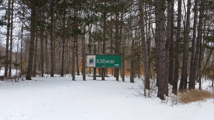 The start of an adventure.
Day 1 Killbear Provincial Park to Woods Rd
December 10th 2016
20.43 km
I dropped my car off on Woods road then Josée dropped me off at the sign of Killbear Provincial park. From there I hiked back to my car. The majority of this section was just walking along the road. The last 9.7 km of the day was along the Muskiig Trail. I saw a few hunters in the middle of trail just waiting for deer to pop out.
 The start of Day 2
Day 2 Woods Road to Nobel Rd
January 8th 2017
15.15 km
I brought my snowshoes for this section. There was quite a bit of powder still left on the trail despite all the snowmobiles that headed through. Once again a lot of road section. The trail is just beside Nobel Road so although your on a trail it feels like another road section.
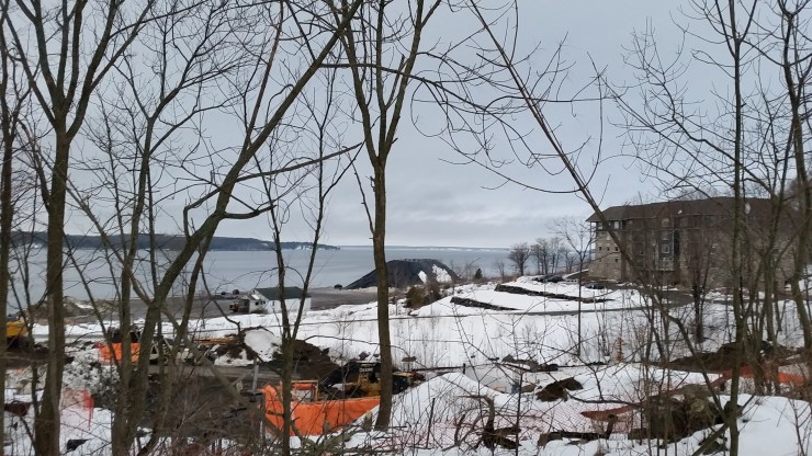 The Big Sound from the Trail (day 3)
Day 3 Nobel Rd to Fitness Trail
January 21st 2017
9.22 km
Most the trail follows Nobel road until it joins with the Salt Docks Trail. The weather wasn’t very nice and the trail was in poor condition so I didn’t hike to far.
Day 4 The Fitness trail
January 29th 2017
3.22km
https://ontarioadventurer.ca/2017/01/29/parry-sound-fitness-trail-and-rugged-trail/
 The Sunset (day 5)
Day 5 The end of Fitness Trail to Rose Point Trail
February 13th
3.28km
This is the road section with a little bit of trail connecting the Fitness trail to the Rose point. Absolutely beautiful sunset that day. I did the hike after work.
Day 6 Rose Point Trail with the lab.
February 23rd 2017
4.99km
https://ontarioadventurer.ca/2017/02/23/rose-point-trail-with-the-lab
 YOU SHALL NOT PASS (day 7)
Day 7 End of Rose Point Trail to Horseshoe Lake Road
February 25th 2017
6.06km
I was getting picked up at the main trail head for the Seguin trail which is just off Horseshoe Lake RD. There’s no parking on Rankin Lake RD where the Seguin Trail starts. There was about a 50 m section of water over the trail that I had to walk through which was very very cold.
 Parking at Horseshoe Lake Road (day 8)
Day 8 Horseshoe Lake Road to Orrville
February 26th 2017
16.6km
This was such a beautiful day and the first 5 km is really beautiful, lots of lakes and variation in the trail. From there its pretty boring and flat. I stopped in Orrville then walked to the bakery where I met Josée who picked me up.
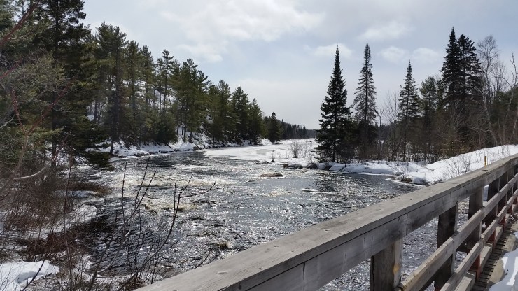
The Sequin River (day 9)
Day 9 Orrville to Bear lake
March 11th 2017
19 km
This is a very nice section of the trail. It was bloody cold in the morning. Something like -20 with a decent wind during the exposed sections. I dropped my car off in Bear Lake then a co-worker picked me up then dropped me off in Orrville. A lot of the trail is along the Seguin river which has now given me the idea to paddle the entire thing.
Day 10 Bear lake to Sprucedale
March 19th 2017
10.9 km
This section continues along the Seguin Trail. So this day was a 21.8 km day but only 10.9 km in the right direction. The start of the trail is the tail end of the Seguin River. I’d say the river starts off of Bear lake. This is a very nice section of the trail.
Day 11 Sprucedale to Walls
March 25th 2017
12.2 km
This section continues along the Seguin Trail. This day I hiked 24.4 km but only 12.2 km of of new trail. The night before there was about 5 cm which made for an awesome hike. Knowing your the only person who has done section of the trail that day is a really cool feeling. Also the fresh powder made for some great photos.
I decided to break up the hike in 3 sections. Once you get to Walls which I did on Day 11 you can continue East on the Seguin Trail or head South and follow the Trans Canada Trail down to Huntsville then follow the Park to Park to Algonquin Park. Both these sections will be in a future post
I’ve Finally completed section two. You can find the link below
https://ontarioadventurer.ca/2017/05/07/park-to-park-part-2-woods-to-algonquin-park/
There are 59 photos on the google my maps so make sure to Full screen it in the top right corner. I took a photo at literally every km so if you want more photos I have tons. Also if you want any gpx/kml files shoot me an e-mail.

One Reply to “”